MAKE A MEME
View Large Image

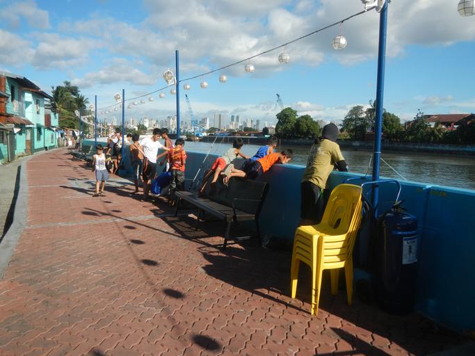
| View Original: | 08362jfPunta Santa Ana Linear Park Pasig River Pandacan Beata Manilafvf 02.jpg (4608x3456) | |||
| Download: | Original | Medium | Small | Thumb |
| Courtesy of: | commons.wikimedia.org | More Like This | ||
| Keywords: 08362jfPunta Santa Ana Linear Park Pasig River Pandacan Beata Manilafvf 02.jpg Pasig River Pasig River Santa Ana - Pandacan Manila section List of crossings of the Pasig River http //wikimapia org/street/15405327/en/Felix-Y-Manalo-Street Felix Y Manalo Street 14ÂḞ35'15 N 121ÂḞ0'58 E http //wikimapia org/34829427/Punta Punta 14ÂḞ35'11 N 121ÂḞ0'56 E Pasig River Ferry Service under the Metropolitan Manila Development Authority http //wikimapia org/10351067/tl/Barangay-898-Zone-100-Punta-Sta-Ana Barangay 898 Zone 100 Punta Santa Ana Maynila 14ÂḞ35'15 N 121ÂḞ0'47 E http //wikimapia org/34829427/Punta Punta 14ÂḞ35'11 N 121ÂḞ0'56 E Linear Park Pasig River Punta Santa Ana to MRI Food Terminal in the List of barangays of Metro Manila Legislative districts of Manila 6th District Barangays 893 894 and 895 Zone 99 District VI Kalentong Barangays 896 897 Zone 99 898 899 Zone 100 District VI Punta Santa Ana Manila in front of the List of barangays of Metro Manila Legislative districts of Manila 6th District Barangays 833 and 834 Zone 91 Barangays 830 and 831 Zone 90 Barangays 832 Zone 90 833 834 835 and 836 Zone 91 Barangays 837 838 839 840 Zone 91 865 Zone 94 District VI Pandacan City of Manila http //wikimapia org/street/17020640/Beata-Street Beata Street http //wikimapia org/street/18210900/Pandacan-Manila Pandacan Palumpong Street and Beata Street Note Judge Florentino Floro the owner to repeat Donor Florentino Floro of all these photos hereby donate gratuitously freely and unconditionally all these photos to and for Wikimedia Commons exclusively for public use of the public domain and again without any condition whatsoever 2016-12-06 14 55 46 own Judgefloro other versions 14 586389 121 015556 heading 90 15 http //wikimapia org/34829427/Punta Punta 14ÂḞ35'11 N 121ÂḞ0'56 E cc-zero Linear Park Pasig River Punta Santa Ana | ||||