MAKE A MEME
View Large Image

| View Original: | 12nm_hypothetical_Territorial_Sea_compared_with_Northern_Limit_Line,_North_Korea.jpg (1315x938) | |||
| Download: | Original | Medium | Small | Thumb |
| Courtesy of: | commons.wikimedia.org | More Like This | ||
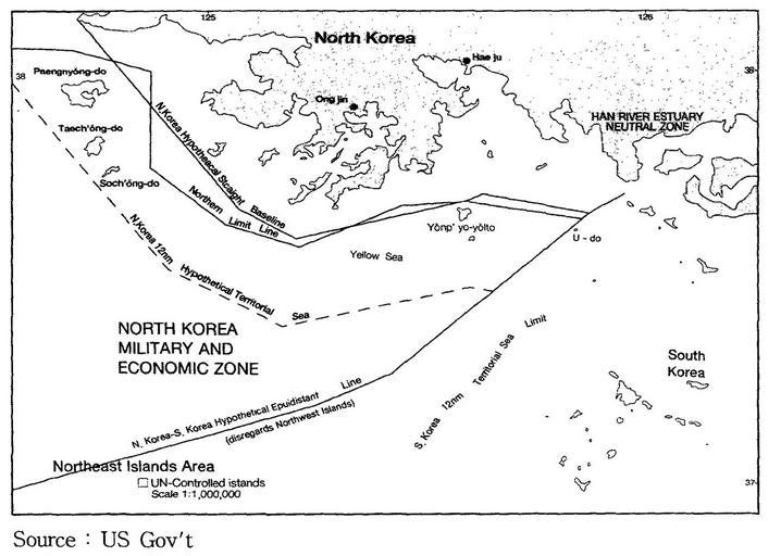
| Keywords: 12nm hypothetical Territorial Sea compared with Northern Limit Line, North Korea.jpg en A US Government map showing where a North Korean 12 nautical mile Territorial Waters limit would be when disregarding the north west UN Command islands compared to the UN Command created Northern Limit Line http //118 129 184 33/pub/docu/kr/AM/06/AM062001B01/IMAGE/AM06-2001-B01-0210-01 jpg US Government date Map taken from HTML version of the paper which included this US Government credited map cite journal http //www kmi re kr/data/linksoft/admin/yun_un/up_file/opr161-06 pdf http //118 129 184 33/pub/docu/kr/AM/06/AM062001B01/AM06-2001-B01-006 HTM http //www kmi re kr/paper/oceanpolicy_view asp pub_idx 7093 pub_paper_idx 13792 Seong-Geol Hong Sun-Pyo Kim Hyung-Ki Lee 2001-06-30 Fisheries Cooperation and Maritime Delimitation Issues between North Korea and Its Neighboring Countries Ocean Policy Research 16 1 191-216 Korea Maritime Institute 2010-11-28 HTML version of paper http //118 129 184 33/pub/docu/kr/AM/06/AM062001B01/AM06-2001-B01-006 HTM According to a Korean Central News Agency article Northern Limit Line rejected of 2 August 2002http //www kcna co jp/item/2002/200208/news08/02 htm 14 the U S government distributed this map to the participants in the UN conference on maritime law held in the U S in 1980 The map is also published in a paper by John Barry Kotch and Michael Abbey in http //www asianperspective org/articles/v27n2-f pdf Asian Perspective Vol 27 No 2 2003 pp 175-204 The CIA report The West Coast Korean Islands BGI RP 74-9 January 1974 Declassified 2000-04-18 as CIA-RDP-84-00825R000300120001-7 http //www kpajournal com/declassified-documents-old/The 20West 20Coast 20Islands 20January 201974 pdf describes this or a very similar map However the map itself is redacted from the declassified version of the report PD-USGov Maps of Korea Yellow Sea | ||||