MAKE A MEME
View Large Image
| View Original: | 1740_Zatta_Map_of_Central_France_and_the_Vicinity_of_Paris_-_Geographicus_-_FranceCentral-italian-1740.jpg (3000x2282) | |||
| Download: | Original | Medium | Small | Thumb |
| Courtesy of: | commons.wikimedia.org | More Like This | ||
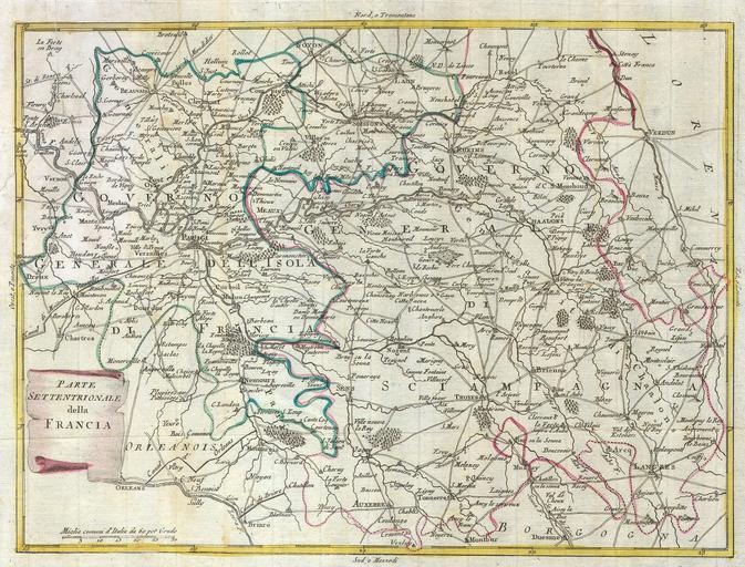
| Keywords: 1740 Zatta Map of Central France and the Vicinity of Paris - Geographicus - FranceCentral-italian-1740.jpg This map is a hand colored depiction of central France the vicinity of Paris by an A Zatta Map depicts France from Chartes in the West to Langres in the Southeast to Verdun in the Northeast Paris is central Map is beautifully rendered in the late 18th century style 1740 Size in 14 11 accession number FranceCentral-italian-1740 object history credit line Geographicus-source PD-old-100 Old maps of the history of France 1740 maps Antonio Zatta Maps in Italian | ||||