MAKE A MEME
View Large Image

| View Original: | 1780_Bonne_Map_of_Southern_India,_Ceylon,_and_the_Maldives_-_Geographicus_-_IndiaSouth-bonne-1780.jpg (2500x1667) | |||
| Download: | Original | Medium | Small | Thumb |
| Courtesy of: | commons.wikimedia.org | More Like This | ||
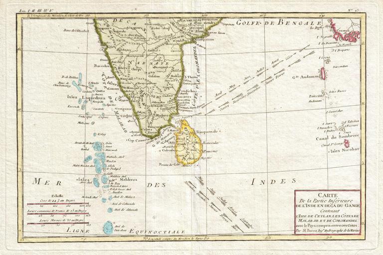
| Keywords: 1780 Bonne Map of Southern India, Ceylon, and the Maldives - Geographicus - IndiaSouth-bonne-1780.jpg Attractive 1780 map of southern India by the French cartographer Rigobert Bonne Covers from the Deccan plateau south as far as the Maldives and as far east as the Andaman and Nicobar Islands Includes Ceylon or Sri Lanka Shows the direction of the important Indian Ocean trade winds and their corresponding seasons The regularity of the trade winds in the Indian Ocean generated active nautical trade routes well into antiquity Published as plate no L 3 in Bonne's 1780 Atlas de Toutes les Parties Connues du Globe Terrestre 1780 undated Size in 13 8 5 object history credit line accession number IndiaSouth-bonne-1780 Bonne R <i>Atlas de Toutes les Parties Connues du Globe Terrestre</i> 1780 Geographicus-source PD-old-100 Old maps of South India Old maps of Sri Lanka 1780 maps of India Old maps of the Indian Ocean Maps of India and Sri Lanka French language maps of Sri Lanka | ||||