MAKE A MEME
View Large Image

| View Original: | 1810_Japanese_map.jpg (344x317) | |||
| Download: | Original | Medium | Small | Thumb |
| Courtesy of: | commons.wikimedia.org | More Like This | ||
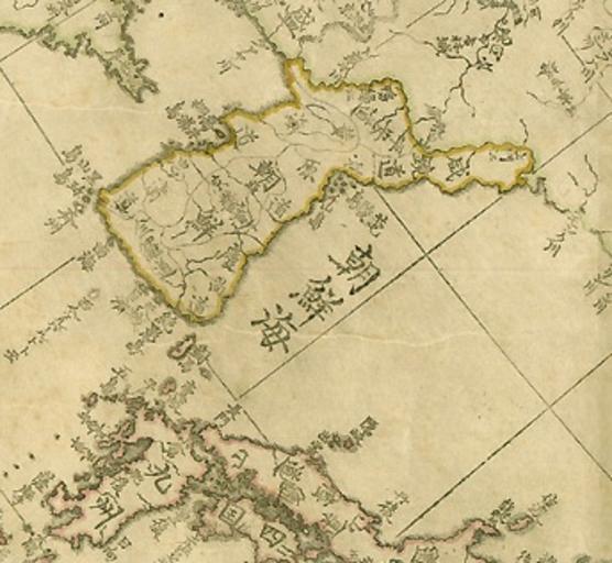
| Keywords: 1810 Japanese map.jpg Japanese map µ¢░Ķ©éĶÉ¼Õ ŗÕģ©Õ ¢ The map 202 centimeters in length and 118 centimeters in width was drawn up in 1807 by Takahashi Kakeyasu an astronomer of the Edo Period The map was printed from a copperplate in 1810 Early 19th century Japanese map that marked the seaway between Korea and Japan as Sea of Joseon µ ķ««µĄĘ Joseon was the old name of Korea from 1392-1910 http //record museum kyushu-u ac jp/kageyasu/kage03 html 1810 Takahashi Kakeyasu Astronomer to the Edo shogunate http //www ndl go jp/zoshoin/e/e_17_takahasi html <br /> PD-old-100 Original upload log en wikipedia Innotata CommonsHelper page en wikipedia 1810_Japanese_map jpg 2010-08-22 06 34 660gd4qo 344├Ś317├Ś 60951 bytes <nowiki> Japanese map µ¢░Ķ©éĶÉ¼Õ ŗÕģ©Õ ¢ 1810 Takahashi Kakeyasu Astronomer to the Edo shogunate http //www ndl go jp/zoshoin/e/e_17_takahasi html http //record museum kyushu-u ac jp/kageyasu/kage03 html The map 202 centimeters in length and 118 centimeters in width was drawn up in 1807 by Takahashi Kakeyasu an astronomer of the Edo Period It has been preserved in the central library of Seoul National University for some time ragged at the edges and its covers partially torn The map was printed from a copperplate in 1810 arly 19th century Japanese map that marked the seaway between Korea and Japan as Sea of Joseon µ ķ««µĄĘ Joseon was the old name of Korea from 1392-1910 PD-Art Maps </nowiki> 2010-08-22 06 31 660gd4qo 450├Ś383├Ś 320029 bytes <nowiki> Japanese map µ¢░Ķ©éĶÉ¼Õ ŗÕģ©Õ ¢ 1810 Takahashi Kakeyasu Astronomer to the Edo shogunate http //www ndl go jp/zoshoin/e/e_17_takahasi html http //record museum kyushu-u</nowiki> Old maps of Korea Old maps of Japan Old maps of the Sea of Japan Takahashi Kageyasu | ||||