MAKE A MEME
View Large Image

| View Original: | 1827 Finley Map of Eastern Pennsylvania, en-antd Lehigh-Susquehanna & Susquehanna-Tioga Turnpike.jpg (1850x2032) | |||
| Download: | Original | Medium | Small | Thumb |
| Courtesy of: | commons.wikimedia.org | More Like This | ||
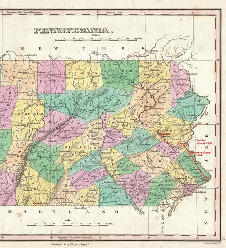
| Keywords: 1827 Finley Map of Eastern Pennsylvania, en-antd Lehigh-Susquehanna & Susquehanna-Tioga Turnpike.jpg Lehigh Susquehanna Turnpike 1804 and the Susquehanna Tioga Turnpike 1806 which would by design intent of the latter's founders eventually connect Philadelphia's manufacturies to the Great Lakes via Tioga County Pennsylvania and Tioga NY Elmira New York 1827 File 1827 Finley Map of Pennsylvania - Geographicus - Pennsylvania-finley-1827 jpg Anthony Finley edited by User Fabartus PD-1923 other versions Full markup - File 1827 Finley Map of Eastern Pennsylvania - Wagon Roads and Turnpikes png--marked up to show road network in late 1820s Blank - File 1827 Finley Map of Eastern Pennsylvania - Geographicus - Pennsylvania-finley-1827 jpg--Blanked unmarked up source of Central Eastern Pennsylvania in late 1820s User Fabartus/FABImage 1 Derived of Finley's important 1827 map of Pennsylvania Depicts the state with moderate detail in Finley's classic minimalist style Shows river ways roads canals and some topographical features Offers color coding at the county level Title at top center Scale at bottom center ;Note many counties would change from those boundaries shown on this map as larger counties were broken into new counties Engraved by Young and Delleker for the 1827 edition of Anthony Finley's General Atlas <br /> The w Allegheny Plateau the Eastern drainage divide and the emphasis the cartographer placed on the Allegheny Front barrier range is obvious in this minimalist styled 19th century map <br />So lightly settled were the lands the cartographer has traced known <u>trails</u> likely proven wagon tracks primitive dirt roads throughout; with the exposed and unsettled lands the work clearly shows their convergence through the few climbable 'gaps in the Allegheny ' Front <br />Note this map is three years after the legislation authorizing the Allegheny Portage Railroad and the Main Line of Public Works and Pennyslvania Canal System that would connect Philadelphia to the Ohio River The portage railroad ascends the gap due east of the mining town of Ebensburg PA 'Gaps in the Allegheny' term used in A History of Pennsylvania dated ca 1893 1827 undated Size in 11 5 9 object history credit line accession number Pennsylvania-finley-1827 Finley Anthony <i>A New General Altas Comprising a Complete Set of Maps representing the Grand Divisions of the Globe Together with the several Empires Kingdoms and States in the World; Compiled from the Best Authorities and corrected by the Most Recent Discoveries</i> Philadelphia 1827 Geographicus-source PD-old-100 thumb left File 1827 Finley Map of Eastern Pennsylvania - Wagon Roads and Turnpikes png--marked up to show road network in late 1820s thumb Blank - File 1827 Finley Map of Eastern Pennsylvania - Geographicus - Pennsylvania-finley-1827 jpg--Blanked unmarked up source of Central Eastern Pennsylvania in late 1820s Anthony Finley Maps by Anthony Finley 1827 maps Old maps of Pennsylvania | ||||