MAKE A MEME
View Large Image
| View Original: | 1850_Mitchell_Map_of_Prussia_Germany_-_Geographicus_-_Prussia-m-50.jpg (2000x1620) | |||
| Download: | Original | Medium | Small | Thumb |
| Courtesy of: | commons.wikimedia.org | More Like This | ||
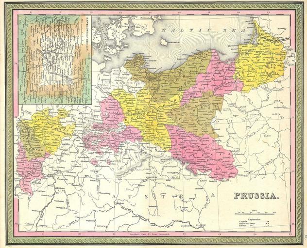
| Keywords: 1850 Mitchell Map of Prussia Germany - Geographicus - Prussia-m-50.jpg This hand colored map is a copper plate engraving dating to 1850 by the legendary American mapmaker S A Mitchell the elder It represents Prussia This map features a detailed inset map of Berlin Most major national and local political distinctions are outlined and defined by vibrant color reds greens yellows browns This map is dated and copyrighted 1850 1850 dated Size in 15 13 object history credit line accession number Prussia-m-50 <i>A New Universal Atlas Containing Maps of the various Empires Kingdoms States and Republics Of The World </i> 1850 issue Geographicus-source PD-old-100 Maps by Samuel Augustus Mitchell Old maps of Prussia 1850 maps Maps in English Old maps of Brandenburg | ||||