MAKE A MEME
View Large Image

| View Original: | 1853_U.S.C.S._Map_or_Chart_of_Florida_-_Geographicus_-_WesternFlorida-uscs-1853.jpg (4000x5537) | |||
| Download: | Original | Medium | Small | Thumb |
| Courtesy of: | commons.wikimedia.org | More Like This | ||
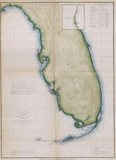
| Keywords: 1853 U.S.C.S. Map or Chart of Florida - Geographicus - WesternFlorida-uscs-1853.jpg A rare costal chart of Florida by the U S Coast Survery 1853 Depicts the whole of the Florida peninsula but specifically details the western coastline showing all bays and harbors as well as accurately mapping the Florida Keys Shows few internal features however does note the Indian Hunting Grounds and the Everglades With the exception of the Key Biscayne Bay Miami area the eastern coast of Florida is largely without detail Produced in 1853 under the Supervision of A D Bache the most influential leader of the Coast Survey Dated 1853 Size in 23 5 17 object history credit line accession number WesternFlorida-uscs-1853 Geographicus-source PD-art United States Coast Survey maps Old maps of Florida 1853 maps | ||||