MAKE A MEME
View Large Image
| View Original: | 1855_Colton_Map_of_New_Hampshire_-_Geographicus_-_NewHampshire-colton-1855.jpg (3247x4000) | |||
| Download: | Original | Medium | Small | Thumb |
| Courtesy of: | commons.wikimedia.org | More Like This | ||
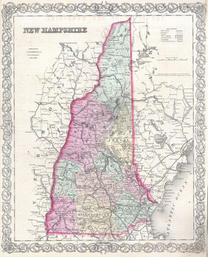
| Keywords: 1855 Colton Map of New Hampshire - Geographicus - NewHampshire-colton-1855.jpg One of the few maps specifically of New Hampshire published in the mid- 19th century Depicts the state in full with superb detail regarding the cities transportation system geographical features and counties Prepared by J H Colton for inclusion as plate no 10 in the 1855 issue of Colton ™s New General Atlas Dated and copyrighted Entered according to act of Congress in the year 1855 by J H Colton Co in District Court for the Southern Dist of New York 1855 dated Size in 13 16 object history credit line accession number NewHampshire-colton-1855 Colton G W <i>Colton's Atlas of the World Illustrating Physical and Political Geography</i> Vol 1 New York 1855 First Edition Geographicus-source PD-old-100 Maps by Joseph Hutchins Colton Old maps of New Hampshire | ||||