MAKE A MEME
View Large Image
| View Original: | 1859_Colton_Map_of_Arkansas_-_Geographicus_-_Arkansas-colton-1860.jpg (4000x3292) | |||
| Download: | Original | Medium | Small | Thumb |
| Courtesy of: | commons.wikimedia.org | More Like This | ||
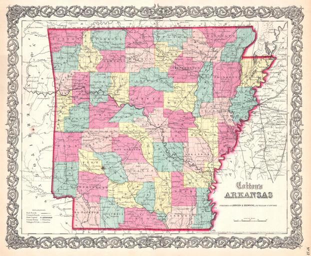
| Keywords: 1859 Colton Map of Arkansas - Geographicus - Arkansas-colton-1860.jpg This rare hand colored map of Arkansas is a copper plate engraving dating to 1859 Produced by the important mid 19th century American map publisher J H Colton Covers the region in considerable detail documenting roads railroads canals counties and topographical features Prepared out of Colton's 172 William St New York office for inclusion as plate no 73 in the 1859 issue of Colton's General Atlas Though the copyright is 1855 the Johnson Browning imprint firmly dates this map to 1859 the year the Johnson partnered with the Colton firm but one year before Johnson started producing his own map plates Dated and copyrighted Entered according to Act of Congress in the Year 1855 by J H Colton Co in the Clerk's Office of the District Court of the United States for the Southern District of New York 1855 dated 1859 imprint Size in 16 13 object history credit line accession number Arkansas-colton-1860 Geographicus-source PD-old-100 Maps by Joseph Hutchins Colton Old maps of Arkansas | ||||