MAKE A MEME
View Large Image

| View Original: | 1861_Schaus_Bird's_Eye_View_Map_of_Virginia,_Delaware,_and_North_Carolina_(Seat_of_War)_-_Geographicus_-_SeatofWar-schaus-1861.jpg (5000x4006) | |||
| Download: | Original | Medium | Small | Thumb |
| Courtesy of: | commons.wikimedia.org | More Like This | ||
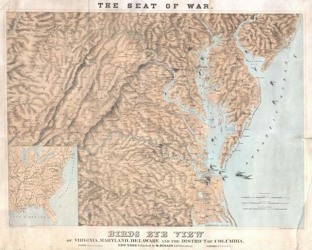
| Keywords: 1861 Schaus Bird's Eye View Map of Virginia, Delaware, and North Carolina (Seat of War) - Geographicus - SeatofWar-schaus-1861.jpg This is a highly unusual and uncommon map or bird's eye view of the seat of the American Civil War in Virginia Delaware Maryland North Carolina and the District of Columbia Issued in New York Paris and France to address the national and international fascination with the ongoing events of the American Civil War Shows the contested territories around Richmond and Washington D C where most of the bloodiest Civil War battles were fought Offers astounding detail throughout showing towns cities river ways and extensive topographical detail Numerous steam powered ships are shown plying the waters of the Chesapeake Bay the Delaware Bay the Atlantic Ocean and this region's numerous navigable rivers Drawn and copyrighted by W Schaus of 629 Broadway New York Published in three stone lithograph format in 1861 by the New York firm of Sarony Major Knapp 1861 undated Size in 29 75 22 25 object history credit line accession number SeatofWar-schaus-1861 Geographicus-source PD-art Old maps of the American Civil War 1861 maps | ||||