MAKE A MEME
View Large Image

| View Original: | 1864_-_1777_Valentine_-_Des_Barres_Map_of_New_York_City_and_Harbor_-_Geographicus_-_NewYork-howevalentine-1864.jpg (4255x6000) | |||
| Download: | Original | Medium | Small | Thumb |
| Courtesy of: | commons.wikimedia.org | More Like This | ||
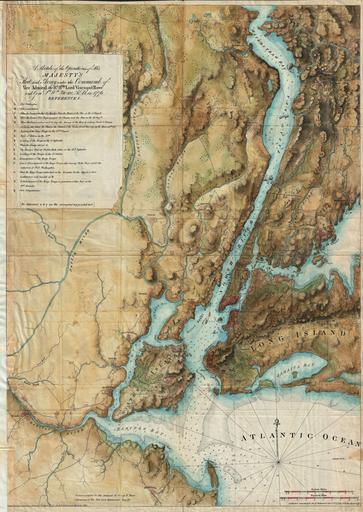
| Keywords: 1864 - 1777 Valentine - Des Barres Map of New York City and Harbor - Geographicus - NewYork-howevalentine-1864.jpg A rare and stunning reissue of the Des Barres famous 1777 Map of New York City and Harbor prepared for the 1864 issue of Valentine ôs Manual of New York Covers from Sandy Hook northward as far as Haverstraw and the Croton River Includes Staten Island all of Manhattan much of northeastern New Jersey and Long Island as far east as Jamaica This stunning map was originally drawn by Joseph Des Barres to illustrate British troop movements during the American Revolutionary War Wonderful topographic detail of the entire region with depth soundings through the harbor With the original Des Barres map all but unobtainable this is a rare opportunity to acquire a 19th century example of this spectacular map 1864 dated Size in 23 32 object history credit line accession number NewYork-howevalentine-1864 <i>Valentine's Manual of the Corporation of the City of New York</i> 1864 edition Geographicus-source PD-art Old maps of New York City 1864 maps Valentine's Manual | ||||