MAKE A MEME
View Large Image

| View Original: | 1871_Hardy_Map_of_New_York_City_Fire_Departments_-_Geographicus_-_NewYorkFire-hardy-1871.jpg (3500x3057) | |||
| Download: | Original | Medium | Small | Thumb |
| Courtesy of: | commons.wikimedia.org | More Like This | ||
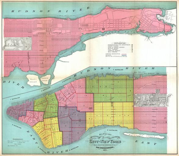
| Keywords: 1871 Hardy Map of New York City Fire Departments - Geographicus - NewYorkFire-hardy-1871.jpg This is large map 1871 map of New York City ôs fire departments Covering all of Manhattan this map defines which fire battalions and brigades are in charge of each area When Hardy issued this map there were but nine fire battalions in Manhattan The locations of Fire Departments Engine Houses Hook Ladder Houses Repair Shops Fuel Depots Hospitals and bell towers are all noted In addition to Fire Commission information this map also shows the proposed and eventually realized landfills along the Manhattan shorelines The expansion of the Manhattan shore line eventually lead to the development of FDR Drive the West Side Highway and a greatly expanded Riverside Park This map is brightly colored in pastels to further illustrate the various divisions All streets are labeled Published by John Hardy Clerk of the Common Council for the 1871 edition of the Manual of the Corporation of New York 1871 dated Size in 19 5 17 object history credit line accession number NewYorkFire-hardy-1871 Hardy John <i>Manual of the Corporation of the City of New York</i> 1870 Geographicus-source PD-art Old maps of Manhattan New York City 1871 maps New York City New York City Fire Department Old maps showing the West Side Line Old maps of Manhattan north of 155th Street | ||||