MAKE A MEME
View Large Image

| View Original: | 1874_Dripps_Map_of_the_Bays,_Harbors_and_Rivers_around_New_York_City,_New_York_-_Geographicus_-_NewYork-asheradams-1874.jpg (4977x6000) | |||
| Download: | Original | Medium | Small | Thumb |
| Courtesy of: | commons.wikimedia.org | More Like This | ||
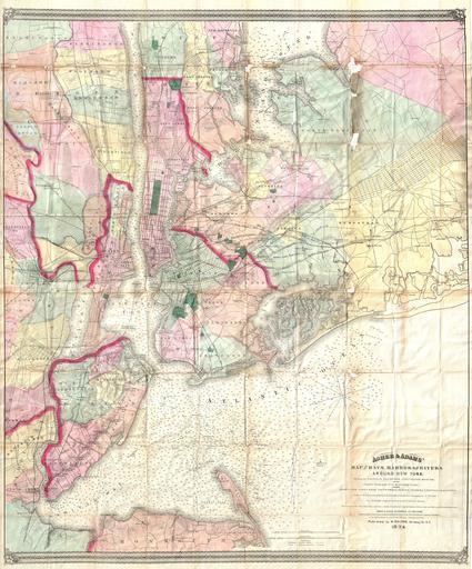
| Keywords: 1874 Dripps Map of the Bays, Harbors and Rivers around New York City, New York - Geographicus - NewYork-asheradams-1874.jpg A visually stunning and extremely rare 1874 pocket map of the greater New York City area innovatively combining detailed land surveys with the work of the U S Coast Survey Covers the New York City area from Sandy Hook and Monmouth County north to include Staten Island Newark Manhattan and Yonkers Extends eastward into Long Island as far as Hicksville Jericho and Freeport Includes all of Brooklyn Jamaica Bay Queens parts of Westchester and much of northeastern New Jersey Offers a detailed view of the streets roadways railroads farmlands islands swamps and parks of the region Includes the Croton Aqueduct Nautically this map is heavily based upon the 1856 U S Coast survey of the same region compiled under the direction of A D Bache Offers thousands of depth soundings noting channels buoys and lighthouses where appropriate Published by Matthew Dripps working in conjunction with the Asher and Adams firm 1874 dated Size in 27 33 object history credit line accession number NewYork-asheradams-1874 Geographicus-source PD-art Old maps of New York City 1874 1874 maps Maps of rivers in New York | ||||