MAKE A MEME
View Large Image

| View Original: | (1879)_MAP_OF_CROATIA,_SLAVONIA,_DALMATIA_&_'MILITĂ„RGRENZE'_of_AUSTRIAN_EMPIRE.jpg (5109x5033) | |||
| Download: | Original | Medium | Small | Thumb |
| Courtesy of: | commons.wikimedia.org | More Like This | ||
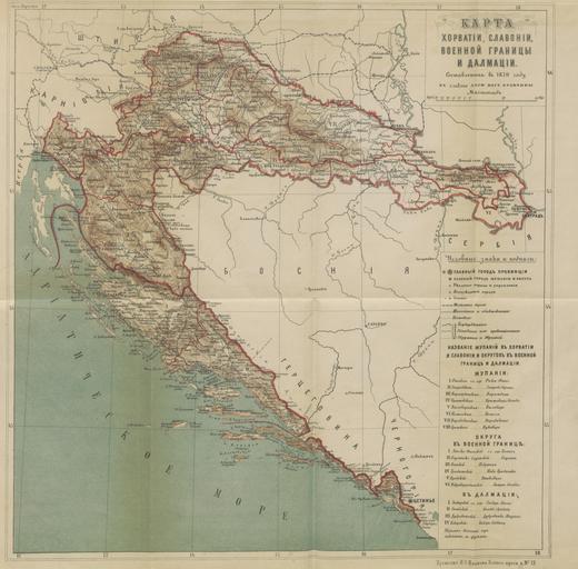
| Keywords: (1879) MAP OF CROATIA, SLAVONIA, DALMATIA & 'MILITĂ„RGRENZE' of AUSTRIAN EMPIRE.jpg ru ĐĄĐľŃ Đ˛Đ°Ń‚Ń–ŃŹ Славонія Далмація и Военная Đ“Ń Đ°Đ˝Đ¸Ń†Đ° Flickr http //www flickr com/photos/britishlibrary/11129674873 Image taken from page 555 of 'ĐĄĐľŃ Đ˛Đ°Ń‚Ń–ŃŹ Славонія Далмація и Военная Đ“Ń Đ°Đ˝Đ¸Ń†Đ° ' - Volume 2 Image taken from <strong>Title</strong> ĐĄĐľŃ Đ˛Đ°Ń‚Ń–ŃŹ Славонія Далмація и Военная Đ“Ń Đ°Đ˝Đ¸Ń†Đ° <br /> <strong>Author</strong> BEREZIN Leonid V <br /> <strong>Shelfmark</strong> British Library HMNTS 10126 g 30 <br /> <strong>Page</strong> <br /> <strong>Place of Publishing</strong> St Petersburg <br /> <strong>Date of Publishing</strong> 1879 <br /> <strong>Issuance</strong> monographic <br /> <strong>Identifier</strong> 000281618 <br /> <br /> Scan courtesy of The British Library User Flickr upload bot/upload-pd 10 01 30 November 2013 UTC Jheald <br /> DEFAULTSORT 1879 000281618 0555 PD-Old PD-US no bookcat Images from the British Library Mechanical Curator collection 1879 maps Maps from the Mechanical Curator collection Maps of the Croatia-Slavonia | ||||