MAKE A MEME
View Large Image

| View Original: | AMH-5096-NA_Map_of_Hout_Bay_and_surrounding_area.jpg (2400x1798) | |||
| Download: | Original | Medium | Small | Thumb |
| Courtesy of: | commons.wikimedia.org | More Like This | ||
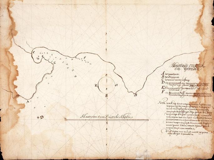
| Keywords: AMH-5096-NA Map of Hout Bay and surrounding area.jpg Artwork nl Kaart van de Houtbay en omgeving nl Titel in catalogus Leupe Nationaal Archief Kaart van Houtbay's omtrek en gronden Randen links en rechts met scheurtjes en grote vochtplekken; de kompaslijnen gedrukt Notities verso Caerte van de Houtbay / No 10 volgnummer van het stuk in de band / uit brieven en papieren van de Kaap overgekomen in 1662 no 10 / 186 in rood potlood en Title in Leupe catalogue National Archives Kaart van Houtbay's omtrek en gronden Left and right edges torn and badly stained; the compass lines have been printed Notes on reverse Caerte van de Houtbay / No 10 serial number of the item in the volume / uit brieven en papieren van de Kaap overgekomen in 1662 no 10 / 186 in red pencil Atlas of Mutual Heritage na http //www atlasofmutualheritage nl/en/object/ id 5096 Source at the Atlas of Mutual Heritage - http //www gahetna nl/collectie/archief/inventaris/index/eadid/4 VEL/inventarisnr/186/level/file Source at the Nationaal Archief en Subjects key chart / map / plan nl Onderwerpen legenda plattegrond / kaart Inscription Houtbaijs omtrek en gronden nl circa 1662 nl Anoniem / Anonymous landmeter / kaartenmaker en Anoniem / Anonymous land surveyor / mapmaker Institution Nationaal Archief nl pen op papier en pen on paper Size cm 40 51 accession number NL-HaNA_4 VEL_186 old number VEL0186 PD-Art-100 1662 | ||||