MAKE A MEME
View Large Image

| View Original: | AMH-6801-NA_Chart_of_Isla_da_Vaca_near_Hispaniola,_Haïti.jpg (2400x1772) | |||
| Download: | Original | Medium | Small | Thumb |
| Courtesy of: | commons.wikimedia.org | More Like This | ||
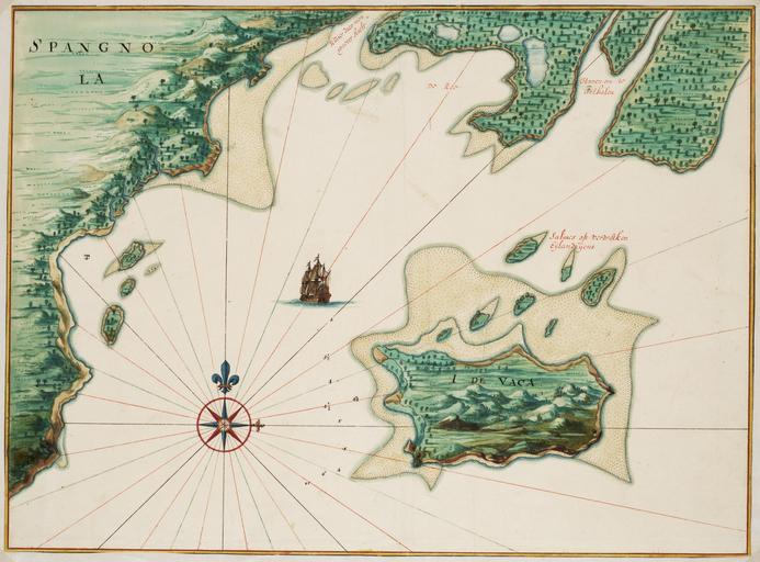
| Keywords: AMH-6801-NA Chart of Isla da Vaca near Hispaniola, Haïti.jpg Artwork nl Kaart van Isla da Vaca bij Hispaniola Haïti nl Titel catalogus Leupe NA Kaart van Isla de Vaca bij St Domingo Met loodingen bis Kaart van I da Vaca bij Hispaniola Bijzonderheden de kaart hoort bij de Atlas Vingboons Er is nog een versie van deze kaart die heeft in de catalogus van Leupe Nationaal Archief het inventarisnummer VELH 619 103a en Title in the Leupe catalogue NA Kaart van Isla de Vaca bij St Domingo Met loodingen bis Chart of I da Vaca bij Hispaniola Remarks the chart is included in the Vingboons Atlas There is another version of this map which in the Leupe catalogue National Archives carries the inventory number VELH 619 103a Atlas of Mutual Heritage na http //www atlasofmutualheritage nl/en/object/ id 6801 Source at the Atlas of Mutual Heritage - http //www gahetna nl/collectie/archief/inventaris/index/eadid/4 VELH/inventarisnr/619 103/level/file Source at the Nationaal Archief en Subjects chart / map / plan ship / vessel compass / dial flora nl Onderwerpen plattegrond / kaart schip / vaartuig kompas / windroos flora circa 1665 Creator Johannes Vingboons nl Johannes Vingboons landmeter / kaartenmaker en Johannes Vingboons land surveyor / mapmaker Institution Nationaal Archief nl aquarel/waterverf op papier en watercolour on paper Size cm 42 57 accession number NL-HaNA_4 VELH_619 103 old number VELH0619 103b PD-Art-100 1665 | ||||