MAKE A MEME
View Large Image

| View Original: | Atlas_Beudeker-C9E10_044_14X-PLAN_DE_MAESTRICH.jpeg (5500x4202) | |||
| Download: | Original | Medium | Small | Thumb |
| Courtesy of: | commons.wikimedia.org | More Like This | ||
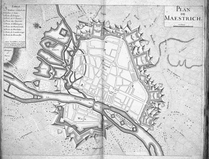
| Keywords: Atlas Beudeker-C9E10 044 14X-PLAN DE MAESTRICH.jpeg Na de inname van de stad in 1632 door Frederik Hendrik was Maastricht uitgebouwd tot een sterke vesting op de grens met de door Spanje beheerste Zuidelijke Nederlanden Dit militaire aspect komt goed tot uiting in deze plattegrond van de stad die in 1708 in Parijs werd uitgegeven Dat juist in Parijs zon gedetailleerde kaart van de vesting werd gepubliceerd is niet zo vreemd Frankrijk was sinds 1702 met de Republiek en Engeland in een oorlog verwikkeld met de Spaanse Nederlanden als belangrijkste inzet Hoewel het niet tot een beleg van de stad kwam werd de verovering van militaire bolwerk wel degelijk overwogen After the capture of the city in 1632 by Frederik Hendrik Maastricht was built up as a strong fortress at the border of the Southern Netherlands which was ruled by Spain The military aspect is clearly distinguishable in the city plan published in Paris in 1708 It is not a coincidence that such a detailed map of a fortress was published in Paris France was at war with the Republic and England since 1702 while the objective was the Spanish Netherlands Though the city was never besieged capture of this military stronghold was seriously contemplated by the French 46 x 61 cm exhibition history British Library Kopergravure Technique copper engraving C9E10 044_14X Frederick Henry Prince of Orange Information field Depicted locations Netherlands - Maastricht object history object type Kaart Map PD-old-100 place of creation place of discovery Source page at the http //resolver kb nl/resolve urn urn gvn KONB01 492 Geheugen van Nederland / Memory of the Netherlands website British Library image Maps C 9 e 10 PLAN DE MAESTRICH Uploaded with GWToolset Atlas Beudeker-C9E10 044_14X-PLAN DE MAESTRICH http //resolver kb nl/resolve urn urn gvn KONB01 044_14X size large Atlas Beudeker Old maps of Maastricht | ||||