MAKE A MEME
View Large Image

| View Original: | Atlas_Van_der_Hagen-KW1049B13_075-NOVA_VIRGINIAE_TABULA.jpeg (5500x4321) | |||
| Download: | Original | Medium | Small | Thumb |
| Courtesy of: | commons.wikimedia.org | More Like This | ||
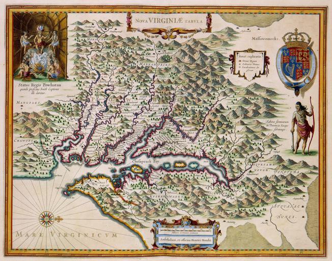
| Keywords: Atlas Van der Hagen-KW1049B13 075-NOVA VIRGINIAE TABULA.jpeg of the Atlas Van der Hagen in the catalogue of the KB http //opc4 kb nl/DB 1/TTL 1/LNG EN/PPN PPN 353012750 Publisher Henrici Hondii Publisher Henrici Hondii credit line 1633-1636 Deze kaart van de Virginia werd oorspronkelijk in 1633 gepubliceerd door Henricus Hondius II 1597-1651 en Jan Janssonius Hier zien we een latere uitgave uit omstreeks 1636 De kaart was gebaseerd op een prototype van de hand van de Engelsman John Smith die deze voormalige Britse kolonie intensief bereisde en zijn bevindingen in 1612 publiceerde Opvallend op de kaart is het interieur van een Indianenhut linksboven ; Linksboven een voorstelling van indianen STTUS REGIS POWHATAN quando praefectus Smit Captivus illi daretur The map of Virginia was originally published in 1633 by Hendicus Hondius 1597-1651 and Jan Janssonius 1588-1664 This is a later edition from 1636 The map was based on a prototype from the hand of John Smith who intensively traveled the British colony and published the results of his travels in 1612 A remarkable aspect on the map is the interior of the Indian hut top left 38 x 50 cm exhibition history Institution Koninklijke Bibliotheek kopergravure Technique copper engraving KW1049B13_075 - Volume 1 Jan Janssonius - Smith John Information field Depicted locations United States of America - Virginia object history object type Kaart Map PD-old-100 place of creation place of discovery Source page at the http //resolver kb nl/resolve urn urn gvn KONB01 423 Geheugen van Nederland / Memory of the Netherlands website Koninklijke Bibliotheek NOVA VIRGINIAE TABULA Uploaded with GWToolset Atlas Van der Hagen-KW1049B13_075-NOVA VIRGINIAE TABULA http //resolver kb nl/resolve urn urn gvn KONB01 1049B13_075 size large Atlas van der Hagen Virginia Old maps of Virginia 1630s maps | ||||