MAKE A MEME
View Large Image

| View Original: | Atlas_Van_der_Hagen-KW1049B10_019-Accurata_SCANIAE_BLEKINCIAE_et_HALLANDIAE_Descriptio.jpeg (5500x4725) | |||
| Download: | Original | Medium | Small | Thumb |
| Courtesy of: | commons.wikimedia.org | More Like This | ||
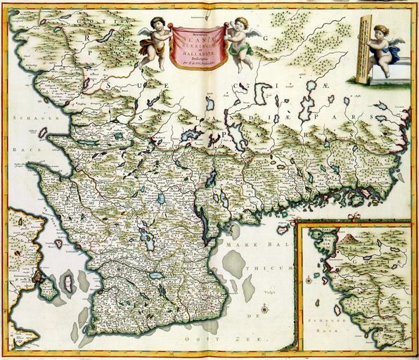
| Keywords: Atlas Van der Hagen-KW1049B10 019-Accurata SCANIAE BLEKINCIAE et HALLANDIAE Descriptio.jpeg of the Atlas Van der Hagen in the catalogue of the KB http //opc4 kb nl/DB 1/TTL 1/LNG EN/PPN PPN 353012750 Creator Frederick de Wit Author and publisher Frederik de Wit Author and publisher Frederik de Wit credit line na 1688 Deze kaart van de zuidelijke provincies van Zweden werd uitgegeven door Frederik de Wit 1630-1706 De Wit had de kaart gekopieerd naar een voorbeeld uit de Atlas Maior van Joan Blaeu 1598-1673 Blaeu op zijn beurt had zijn informatie ontleend aan een grote kartering van het Deense rijk - waartoe ook Zuid-Zweden hoorde - waaraan vanaf 1630 jarenlang werd gewerkt ; Rechtsonder een inzet GOTIAE PARS This map of the southern provinces of Sweden was published by Frederik de Wit 1630-1706 De Wit copied the map after one in the Atlas Maior 1662 published by Joan Blaeu 1598-1673 Blaeu for his part derived information from the survey of the Danish Kingdom carried out after 1630 49 5 x 59 cm exhibition history Institution Koninklijke Bibliotheek kopergravure Technique copper engraving KW1049B10_019 - Volume 1 Frederik de Wit - Joan Blaeu Information field Depicted locations Skane - Blekinge - Halland - Sweden object history object type Kaart Map PD-old-100 place of creation Amsterdam place of discovery Source page at the http //resolver kb nl/resolve urn urn gvn KONB01 19 Geheugen van Nederland / Memory of the Netherlands website Koninklijke Bibliotheek Accurata SCANIAE BLEKINCIAE et HALLANDIAE Descriptio Uploaded with GWToolset Atlas Van der Hagen-KW1049B10_019-Accurata SCANIAE BLEKINCIAE et HALLANDIAE Descriptio http //resolver kb nl/resolve urn urn gvn KONB01 1049B10_019 size large Atlas van der Hagen | ||||