MAKE A MEME
View Large Image

| View Original: | Baffinland Iron Mine.png (513x504) | |||
| Download: | Original | Medium | Small | Thumb |
| Courtesy of: | commons.wikimedia.org | More Like This | ||
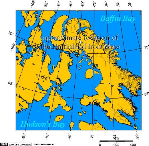
| Keywords: Baffinland Iron Mine.png approximate location of the Baffinland Iron Mine Own 2009-12-12 Geo Swan <span class signature-talk >talk</span> GFDL-GMT Maps of Nunavut Maps of Baffin Island Baffinland Iron Mine 71 183056 -79 35 wikitable This map was self made using this http //www aquarius geomar de/omc/ online map creation tool This map is a Lambert Azimuthal projection The boundaries I used were North 74 - West -92 - East -56 - South 60 3 ImageNote 1 276 167 20 17 513 504 2 Steensby Inlet -- a railway will link the mine to port facilities here Residents of nearby communities like Igloolik Sanirajak Salliit Kinngait and Kimmirut are concerned over the effect the icebreaking freighters will have on sea mammals like Walrus ImageNoteEnd 1 ImageNote 2 267 105 13 17 513 504 2 Milne Inlet -- an alternate rail link was considered from the mine site to Milne Inlet This route would have faced greater construction difficulty from permafrost and had a shorter ice-free period ImageNoteEnd 2 | ||||