MAKE A MEME
View Large Image

| View Original: | Boston_1772.png (1536x1414) | |||
| Download: | Original | Medium | Small | Thumb |
| Courtesy of: | commons.wikimedia.org | More Like This | ||
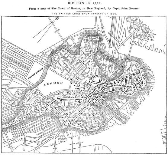
| Keywords: Boston 1772.png Boston in 1772 From a map of The Town of Boston in New England by Capt John Bonner The fainter lines show streets of 1880 From Report on the Social Statistics of Cities Compiled by George E Waring Jr United States Census Office Part I 1886 Edited version of University of Texas image http //www lib utexas edu/maps/historic_us_cities html No permissions are needed to copy them You may download them and use them as you wish http //www lib utexas edu/usage_statement html maps yes 2010-12-08 20 27 02 UTC Original uploaded at 2009-04-20 14 03 26 Original uploaded on en wikipedia Original uploaded by 718 Bot Transfered by ×ž×Ş× ×™×” PD-old-100 History of File Boston 1772 gif 2009-04-20T03 33 40Z Svgalbertian Talk contribs 606 bytes <nowiki>It will resize better if it is PNG</nowiki> 2008-04-16T13 42 56Z MECU Talk contribs 590 bytes <nowiki>remove unneeded tag</nowiki> 2006-09-30T17 10 22Z Beland Talk contribs <nowiki>Category Maps of Boston Massachusetts</nowiki> 2006-06-18T02 59 21Z LGagnon Talk contribs <nowiki>Images of Boston Massachusetts</nowiki> 2006-02-13T21 52 41Z Flux books Talk contribs <nowiki>/ Licensing /</nowiki> 2006-02-13T21 51 13Z Flux books Talk contribs <nowiki> Boston in 1772 From a map of The Town of Boston in New England by Capt John Bonner The fainter lines show streets of 1880 From Report on the Social Statistics of Cities Compiled by George E Waring Jr United States Census Office Part I 188</nowiki> 2006-02-13T21 51 13Z Flux books Talk contribs 1536x1414 305596 bytes Original upload log page en wikipedia Boston_1772 png Upload date User Bytes Dimensions Comment 2009-04-20 14 03 26 718 Bot 274629 1536×1414 <small><nowiki> Summary Boston in 1772 From a map of The Town of Boston in New England by Capt John Bonner The fainter lines show streets of 1880 From Report on the Social Statistics of Cities Compiled by George E Waring Jr United States Census Offi</nowiki></small> Old maps of Boston 1772 maps | ||||