MAKE A MEME
View Large Image

| View Original: | British Isles Venn Diagram-de.svg (256x263) | |||
| Download: | Original | Medium | Small | Thumb |
| Courtesy of: | commons.wikimedia.org | More Like This | ||
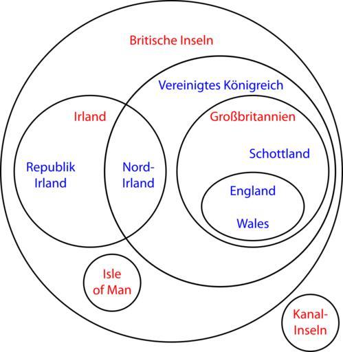
| Keywords: British Isles Venn Diagram-de.svg en Geographical locations are shown in red political entities are in blue german version de Britische Inseln Geografische Bezeichnung sind rot politische blau dargestellt Own work + en File British_Isles_Venn_Diagram png Emdee 2009-07-12 en File British_Isles_Venn_Diagram png Subdivisions of the United Kingdom SVG diagrams in German Membership diagrams | ||||