MAKE A MEME
View Large Image
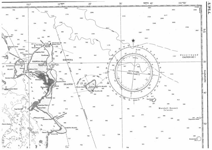
| View Original: | Chart 73620 kiriwina fathoms.gif (2384x1685) | |||
| Download: | Original | Medium | Small | Thumb |
| Courtesy of: | commons.wikimedia.org | More Like This | ||
| Keywords: Chart 73620 kiriwina fathoms.gif en part of nautical chart Nr 73620 of Trobriand Islands to Marshall Bennett Islands not stated http //faculty washington edu/kessler/noumea/bathymetry html NOAA other versions PD-USGov Trobriand Islands Maps of Papua New Guinea | ||||