MAKE A MEME
View Large Image

| View Original: | Clement_Reid_-_Map_Doggerbank.jpg (1020x1291) | |||
| Download: | Original | Medium | Small | Thumb |
| Courtesy of: | commons.wikimedia.org | More Like This | ||
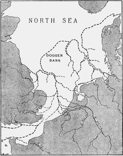
| Keywords: Clement Reid - Map Doggerbank.jpg en Map of Doggersbank North Sea showing approximate Coast-line at the period of the lowest Submerged Forest Clement Reid 1913 Submerged Forests Clement Reid 1913 other fields map historical palaeogeographical map PD-old Holocene geography Palaeogeographic maps of the Netherlands Doggerland Submerged forests Maps of the history of coastlines | ||||