MAKE A MEME
View Large Image

| View Original: | CraterHighlands Tanzania NASA-he1.jpg (540x669) | |||
| Download: | Original | Medium | Small | Thumb |
| Courtesy of: | commons.wikimedia.org | More Like This | ||
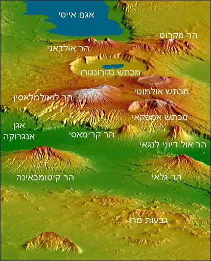
| Keywords: CraterHighlands Tanzania NASA-he1.jpg Topographical map of the w Crater Highlands in Tanzania Color indicates height with lowest elevations in green and highest elevations in white Shading shows the slope The vertical relief has been exaggerated by a factor of 2 to reveal greater detail about the landscape The image is oriented as though you were looking from the north toward the southwest http //earthobservatory nasa gov/Newsroom/NewImages/images php3 img_id 17196 2000-02 NASA/JPL/NGA Shuttle Radar Topography team Labels by NASA Earth Observatory newsroom US government public domain Larger unannotated version available at source URL ×¨×•× ×™×’ PD-USGov-NASA Ngorongoro Topographic maps of Tanzania Lakes of Tanzania February 2000 in Tanzania Topographic shading | ||||