MAKE A MEME
View Large Image

| View Original: | Cyclones_in_the_Pacific_DVIDS702204.jpg (1445x1536) | |||
| Download: | Original | Medium | Small | Thumb |
| Courtesy of: | commons.wikimedia.org | More Like This | ||
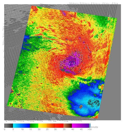
| Keywords: Cyclones in the Pacific DVIDS702204.jpg en The SeaWinds scatterometer aboard NASA's QuikScat satellite collected the data used to create this colorful image of Cyclone Olaf churning in the South Pacific on February 16 2005 The colored background shows the near-surface wind speeds at 2 5-kilometer resolution The strongest winds shown in purple are at the center of the storm with gradually weakening winds forming rings around the center The black barbs indicate wind speed and direction at QuikScat's nominal 25-kilometer resolution; white barbs indicate areas of heavy rain QuikScat Background NASA's Quick Scatterometer QuikScat spacecraft was launched from Vandenberg Air Force Base California on June 19 1999 QuikScat carries the SeaWinds scatterometer a specialized microwave radar that measures near-surface wind speed and direction under all weather and cloud conditions over the Earth's oceans More information about the QuikScat mission and observations is available at http //winds jpl nasa gov QuikScat is managed for NASA's Science Mission Directorate Washington DC by NASA's Jet Propulsion Laboratory Pasadena CA JPL also built the SeaWinds radar instrument and is providing ground science processing systems NASA's Goddard Space Flight Center Greenbelt MD managed development of the satellite designed and built by Ball Aerospace Technologies Corp Boulder CO The National Oceanic and Atmospheric Administration has contributed support to ground systems processing and related activities NASA Identifier PLAN-PIA07415 2009-10-14 Glenn Research Center https //www dvidshub net/image/702204 702204 2012-10-10 15 03 WASHINGTON DC US PD-USGov Vandenberg Air Force Base Images from DoD uploaded by Fæ | ||||