MAKE A MEME
View Large Image

| View Original: | France radar 2.jpg (2172x2074) | |||
| Download: | Original | Medium | Small | Thumb |
| Courtesy of: | commons.wikimedia.org | More Like This | ||
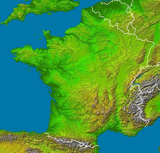
| Keywords: France radar 2.jpg en Subject France viewed by NASA Shuttle radar-imaging ; Source http //earthobservatory nasa gov/Newsroom/NewImages/images php3 img_id 15360 NASA Earth Observatory modified ; Original image in Wikipedia Image France_radar jpg ; This version Without shadows along the borders modified by Sting Location 42 to 51 5 ° North 5 5 West to 8 ° East Orientation North toward the top Mercator projection Image Data shaded and colored SRTM elevation model Original Data Resolution 1 arcsecond ~30 meters Date Acquired February 2000 Projection équirectangulaire top 51 625° bottom 42 00° left -5 75° right 8 75° ---- fr Sujet Image radar de la France vue depuis la navette spatiale par la NASA ; Source http //earthobservatory nasa gov/Newsroom/NewImages/images php3 img_id 15360 NASA Earth Observatory modifiée ; Image originale sur Wikipédia Image France_radar jpg ; Cette version Sans ombres le long des frontières modifiée par Sting Atelier graphique carte The purpose of NASA's Earth Observatory is to provide a freely-accessible publication on the Internet where the public can obtain new satellite imagery and scientific information about our home planet The focus is on Earth's climate and environmental change In particular we hope our site is useful to public media and educators Any and all materials published on the Earth Observatory are freely available for re-publication or re-use except where copyright is indicated We ask that NASA's Earth Observatory be given credit for its original materials PD-USGov-NASA-SRTM fr French Wikipedia Sting Radar images of Earth Topographic maps of France | ||||