MAKE A MEME
View Large Image
| View Original: | Geologische_Karte_vom_Preußen.jpg (3859x4024) | |||
| Download: | Original | Medium | Small | Thumb |
| Courtesy of: | commons.wikimedia.org | More Like This | ||
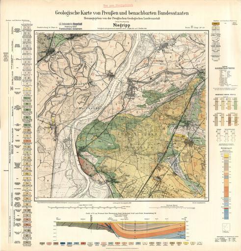
| Keywords: Geologische Karte vom Preußen.jpg Geologische Karte von Preußen und benachbarten Bundesstaaten ˆ’Karte Niegripp ˆ’ Karte erstellt von Johannis Korn geb 1862 bis 1927 von Jakob Stoller geb 1873 bis 1930 von Ernst Zimmermann geb 1860 bis 1944 unter der Leitung von Franz Beyschlag geb 1856 bis 1935 von 1901 bis 1923 Präsident der PGLA PD-Old-100 Herrausgegeben 1923 Preussische Geologische Landes Anstalt cc-by-sa-4 0 Uploaded with UploadWizard Hohenwarthe Geologische Karte von Preußen.jpg Geologische Karte von Preußen und benachbarten Bundesstaaten ˆ’Karte Niegripp ˆ’ Karte erstellt von Johannis Korn geb 1862 bis 1927 von Jakob Stoller geb 1873 bis 1930 von Ernst Zimmermann geb 1860 bis 1944 unter der Leitung von Franz Beyschlag geb 1856 bis 1935 von 1901 bis 1923 Präsident der PGLA PD-old-100 Herausgegeben 1923 Preussische Geologische Landes Anstalt cc-by-sa-4 0 Hohenwarthe | ||||