MAKE A MEME
View Large Image

| View Original: | Gogerddan_estate_map_-_Borough_of_Aberystwith.jpg (5679x3107) | |||
| Download: | Original | Medium | Small | Thumb |
| Courtesy of: | www.flickr.com | More Like This | ||
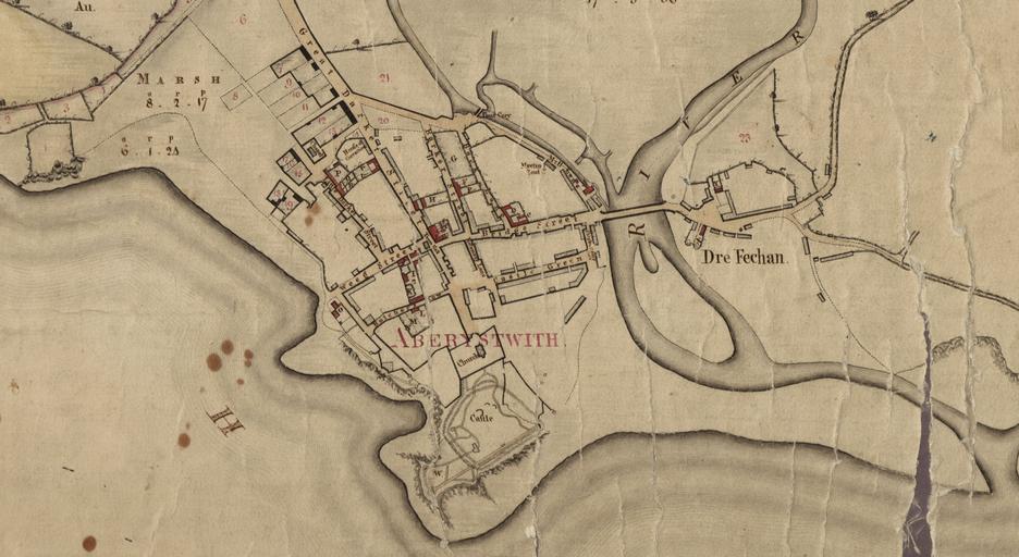
| Keywords: cymru wales llyfrgell genedlaethol cymru llyfrgellgenedlaetholcymru national library of wales nationallibraryofwales maps map cartography aberystwyth sketch drawing tangle texture monochrome Teitl Cymraeg/Welsh title: Crëwr/Creator: unknown Nodyn/Note: Gogerddan Estate Map 110a Dyddiad/Date: 1800? Cyfrwng/Medium: Cyfeiriad/Reference:1445650 Teitl Cymraeg/Welsh title: Crëwr/Creator: unknown Nodyn/Note: Gogerddan Estate Map 110a Dyddiad/Date: 1800? Cyfrwng/Medium: Cyfeiriad/Reference:1445650 <b>Teitl Cymraeg/Welsh title:</b> <b>Crëwr/Creator:</b> unknown <b>Nodyn/Note:</b> Gogerddan Estate Map 110a <b>Dyddiad/Date:</b> 1800? <b>Cyfrwng/Medium:</b> <b>Cyfeiriad/Reference:</b><i><a href="http://hdl.handle.net/10107/1445650" rel="nofollow">1445650</a> </i> cymru wales llyfrgellgenedlaetholcymru nationallibraryofwales maps map cartography aberystwyth Gogerddan Map 110, A map of the Borough of Aberystwith.jpg ~ 1800 1060 780 Institution National Library of Wales credit line 1445609 PD-old-100-1923 thumb left Entire map Estate Maps in the National Library of Wales Images uploaded as part of NLW - WMUK collaboration Estate maps Historical maps of Wales Maps of Aberystwyth Old maps of towns in Wales | ||||