MAKE A MEME
View Large Image
| View Original: | Great_Britain_and_Ireland_old_german_map.jpg (876x1454) | |||
| Download: | Original | Medium | Small | Thumb |
| Courtesy of: | commons.wikimedia.org | More Like This | ||
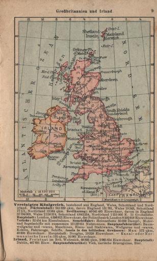
| Keywords: Great Britain and Ireland old german map.jpg pl Mapa Wielkiej Brytanii i Irlandii z niemieckiego atlasu kieszonkowego 1939/1940 en Map of Great Britain and Ireland from german pocket atlas 1939/1940 2015-01-05 12 38 46 Private collection author other versions Custom license marker 2015 01 05 pd-old Uploaded with UploadWizard Old maps of the British Isles 1939 | ||||