MAKE A MEME
View Large Image
| View Original: | Greenwood's_Map_of_Northumberland.jpg (648x851) | |||
| Download: | Original | Medium | Small | Thumb |
| Courtesy of: | commons.wikimedia.org | More Like This | ||
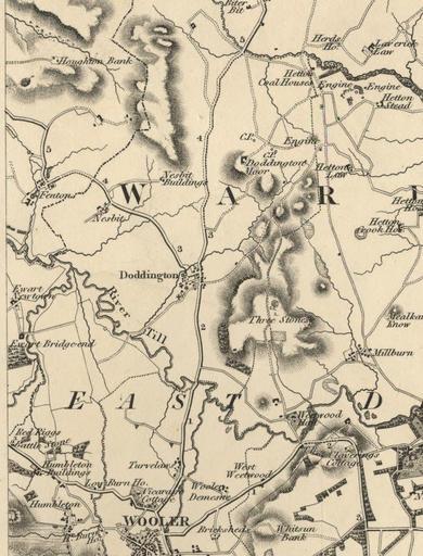
| Keywords: Greenwood's Map of Northumberland.jpg This is a section of Christopher John Greenwoods' Map of the County of Northumberland 1828 showing Doddington and the surrounding area Greenwood's map was drawn to a scale of approximately one inch to three miles It was surveyed and printed between 1827 1828 Source http //communities northumberland gov uk/007358FS htm PD-old Maps of Northumberland | ||||