MAKE A MEME
View Large Image

| View Original: | INDIA_and_the_EASTERN_HEMISPHERE,_1522.jpg (1000x750) | |||
| Download: | Original | Medium | Small | Thumb |
| Courtesy of: | commons.wikimedia.org | More Like This | ||
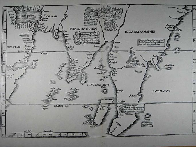
| Keywords: INDIA and the EASTERN HEMISPHERE, 1522.jpg en Tabula nova utriusque Indiae from Claudius Ptolemy 'Geographicae Enarrationis' by Lorenz Fries Vienna Gaspar Trechsel 1541 This is the 4th edition of an unchanged map first published in 1522 Fries' map follows Waldseemuller's first modern map of Asia 1513 but adds an array of vignettes purporting to depict the cultures of the region License qualifies under PD-Art Archived by Columbia University 2007-11-01 04 24 07 http //www columbia edu/itc/mealac/pritchett/00maplinks/mughal/miscmaps1500s/fries1522/fries1522 html Freis PD-US Uploaded with UploadWizard Old maps of India Claudii Ptolemaei Alexandrini Geographicae Enarrationis Libri Octo Ptolemaic Central Asia | ||||