MAKE A MEME
View Large Image
| View Original: | LDYstradyfodwgMap.png (949x977) | |||
| Download: | Original | Medium | Small | Thumb |
| Courtesy of: | commons.wikimedia.org | More Like This | ||
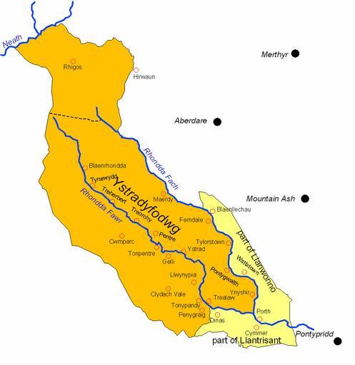
| Keywords: LDYstradyfodwgMap.png Map showing the boundaries of Ystradyfodwg parish Glamorgan Wales and the areas added and subtracted in the formation of Rhondda Urban District en wikipedia Kafuffle CommonsHelper 2007-08-01 LinguisticDemographer wikipedia en LinguisticDemographer Original upload log page en wikipedia LDYstradyfodwgMap png 2007-08-01 01 31 LinguisticDemographer 949×977× 53998 bytes <nowiki>Map showing the boundaries of Ystradyfodwg parish Glamorgan Wales and the areas added and subtracted in the formation of Rhondda Urban District</nowiki> Glamorgan Rhondda Cynon Taf County Borough | ||||