MAKE A MEME
View Large Image

| View Original: | Le royaume des Francs en 548.svg (755x822) | |||
| Download: | Original | Medium | Small | Thumb |
| Courtesy of: | commons.wikimedia.org | More Like This | ||
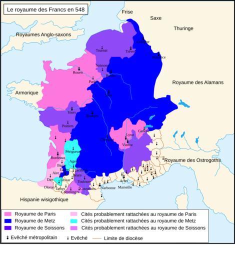
| Keywords: Le royaume des Francs en 548.svg fr Le royaume des Francs en 548 Travail personnel sur un fond de carte hydrographique de historicair D'après Michel Rouche Clovis éditions Fayard 1996 p 370 Romain0 2009-12-28 Maps of Gauls Maps of the Merovingian territory Maps of the Frankish territory SVG maps showing history in French | ||||