MAKE A MEME
View Large Image
| View Original: | Lebec_1943.jpg (964x752) | |||
| Download: | Original | Medium | Small | Thumb |
| Courtesy of: | commons.wikimedia.org | More Like This | ||
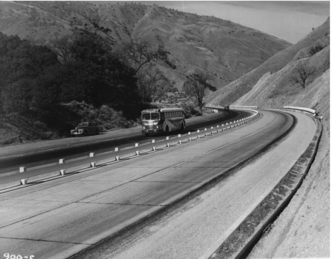
| Keywords: Lebec 1943.jpg en wikipedia 2014 January 5 This is a 1943 photo from the http //www dot ca gov/hq/paffairs/about/photos htm Caltrans site showing the Ridge Alternate down Grapevine grade It is looking north at the curve to the left after the Fort Tejon exit; this can be confirmed by comparing the mountain in the background with about 1/5 through http //video dot ca gov/photolog/KER/KER_005N_05_10 MOV this Caltrans photolog file thus about postmile 6 in Kern County PD-CAGov Original upload log en wikipedia Rschen7754 CommonsHelper en wikipedia Lebec+1943 jpg 2004-08-23 00 26 Lucky 6 9 964×752× 299898 bytes <nowiki>Fair use of public photos per http //www dot ca gov/conditions htm</nowiki> Ridge Route | ||||