MAKE A MEME
View Large Image

| View Original: | Long Island—Congressional Districts 2012.svg (798x318) | |||
| Download: | Original | Medium | Small | Thumb |
| Courtesy of: | commons.wikimedia.org | More Like This | ||
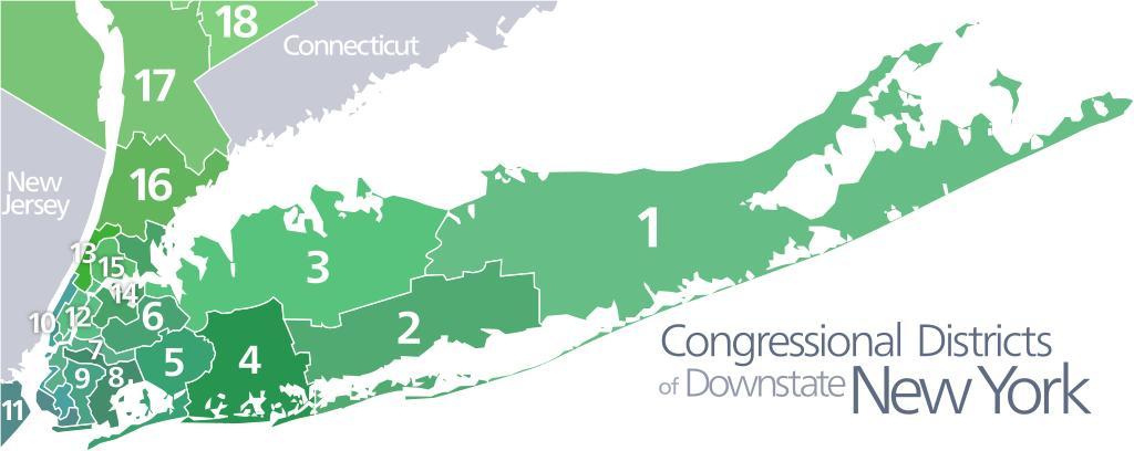
| Keywords: Long Island—Congressional Districts 2012.svg en A map of the new Congressional Districts 1 “18 in downstate New York Based on a map from the https //www nytimes com/interactive/2012/03/20/nyregion/new-york-redistricting html New York Times es Un mapa de los nuevos distritos del congreso 1 “18 en Nueva York del sur Basado en un mapa de https //www nytimes com/interactive/2012/03/20/nyregion/new-york-redistricting html the New York Times 2012-11-22 21 54 37 own Kelvinsong cc-zero Uploaded with UploadWizard Maps of New York Maps of Long Island Congressional district maps of New York | ||||