MAKE A MEME
View Large Image
| View Original: | Map-_France_at_the_Treaty_of_Bretigny.jpg (1107x1389) | |||
| Download: | Original | Medium | Small | Thumb |
| Courtesy of: | commons.wikimedia.org | More Like This | ||
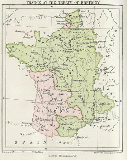
| Keywords: Map- France at the Treaty of Bretigny.jpg Map showing France at the time of the Treaty of Bretigny Taken from History of the English People Volume 2 Transferred from http //en wikipedia org en wikipedia to Commons by User Logan using http //tools wikimedia de/~magnus/commonshelper php CommonsHelper 1877 first publication date John Richard Green PD-US PD-old-100 Original upload log page en wikipedia Map-_France_at_the_Treaty_of_Bretigny jpg 2006-09-09 16 14 Murraypaul 1107×1389× 359949 bytes <nowiki>Map showing France at the time of the Treaty of Bretigny Taken from History of the English People Volume 2 by John Richard Green First published in 1877 </nowiki> 1877 maps Old maps of France 1360 in France English language maps of Europe | ||||