MAKE A MEME
View Large Image

| View Original: | Map_of_French_Guyana_and_of_the_Island_of_Cayenne_WDL1203.png (1422x1024) | |||
| Download: | Original | Medium | Small | Thumb |
| Courtesy of: | commons.wikimedia.org | More Like This | ||
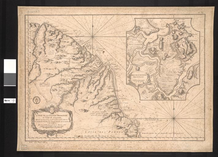
| Keywords: Map of French Guyana and of the Island of Cayenne WDL1203.png Artwork ru ąæąĄą╗ą╗ąĖąĮ ą¢ą░ą║ ą ąĖą║ąŠą╗ą░ 1703-1772 fr Bellin Jacques-Nicolas 1703-1772 en Bellin Jacques Nicolas 1703-1772 zh Ķ┤ Õ«ü ķøģÕģŗ┬ĘÕ░╝ÕÅżµŗē 1703-1772 pt Bellin Jacques Nicolas 1703-1772 ar ž©┘Ŗ┘ä┘å ž¼ž¦┘ā ┘å┘Ŗ┘ā┘ł┘䞦ž│ 1703-1772 es Bellin Jacques Nicolas 1703-1772 ru ąÜą░č čéą░ ążč ą░ąĮčåčāąĘčüą║ąŠą╣ ąōą░ą╣ą░ąĮčŗ ąĖ ąŠčüčéč ąŠą▓ą░ ąÜą░ą╣ąĄąĮ fr Carte de la Guyane fran├¦aise et de l'├«le de Cayenne en Map of French Guyana and of the Island of Cayenne zh µ│ĢÕ▒×Õ Łõ║ÜķéŻõĖÄÕŹĪÕ«┤Õ▓øÕ ░ÕøŠ pt Mapa da Guiana Francesa e da Ilha de Cayenne ar ž«ž▒┘ŖžĘž® ž║┘Ŗž¦┘垦 ž¦┘ä┘üž▒┘åž│┘Ŗž® ┘łž¼ž▓┘Ŗž▒ž® ┘āž¦┘Ŗ┘å ru ąöą░ąĮąĮą░čÅ ą║ą░č čéą░ ążč ą░ąĮčåčāąĘčüą║ąŠą╣ ąōą▓ąĖą░ąĮčŗ ąĖ ąŠčüčéč ąŠą▓ą░ ąÜą░ą╣ąĄąĮąĮ ą▒čŗą╗ą░ čüąŠčüčéą░ą▓ą╗ąĄąĮą░ ą¢ą░ą║ąŠą╝ ąæąĄą╗ą╗ąĖąĮąŠą╝ 1703-1772 ą│ą│ ö┬ĀčüąŠčüčéą░ą▓ąĖč鹥ą╗ąĄą╝ ą╝ąĮąŠą│ąŠčćąĖčüą╗ąĄąĮąĮčŗčģ ą║ą░č čé čüą╗čāąČąĖą▓čłąĖą╝ ą▓┬Āą ąŠč čüą║ąŠą╝ čāą┐č ą░ą▓ą╗ąĄąĮąĖąĖ ążč ą░ąĮčåąĖąĖ ą ą░ ąĮąĄą╣ ą┐č ąĖą▓ąĄą┤ąĄąĮąŠ č鹊čćąĮąŠąĄ ąĖąĘąŠą▒č ą░ąČąĄąĮąĖąĄ ą▒čāčģčé ą╝ąŠč ąĄą╣ ąĖ ą│ą░ą▓ą░ąĮąĄą╣ čüč鹊ą╗čī čģą░č ą░ą║čéąĄč ąĮąŠąĄ ą┤ą╗čÅ ą▓ąŠąĄąĮąĮąŠą╣ ą║ą░č č鹊ą│č ą░čäąĖąĖ ą▓ąŠ┬Āążč ą░ąĮčåąĖąĖ ą▓ XVIII ą▓ąĄą║ąĄ ą¤ąŠą╝ąĖą╝ąŠ ą┐ąŠą┤č ąŠą▒ąĮąŠą╣ ąĖąĮčäąŠč ą╝ą░čåąĖąĖ ąŠ ą┐ąŠą▒ąĄč ąĄąČčīąĄ ą▓ ą║ą░č čéčā ąæąĄą╗ą╗ąĖąĮą░ ą▓ą║ą╗čÄč湥ąĮčŗ ą┐č ąĖą╝ąĄčćą░ąĮąĖčÅ ąŠ ą▓ąĮčāčéč ąĄąĮąĮąĄą╝ č ąĄą│ąĖąŠąĮąĄ ą┤ą░ąĮąĮąŠą╣ čćą░čüčéąĖ ą«ąČąĮąŠą╣ ąÉą╝ąĄč ąĖą║ąĖ ą▒ąŠą╗čīčłą░čÅ čćą░čüčéčī ą║ąŠčéąŠč ąŠą╣ ą▓ č鹊 ą▓č ąĄą╝čÅ ąŠčüčéą░ą▓ą░ą╗ą░čüčī ąĄčēąĄ┬ĀąĮąĄąĖčüčüą╗ąĄą┤ąŠą▓ą░ąĮąĮąŠą╣┬ĀąĄą▓č ąŠą┐ąĄą╣čåą░ą╝ąĖ fr Cette carte de la Guyane fran├¦aise et l'├«le de Cayenne est due ├Ā Jacques Bellin 1703-72 un cartographe prolifique affect├® au minist├©re de la Marine fran├¦aise Elle refl├©te le soin apport├® aux relev├®s topographiques des baies des mers et des ports qui caract├®risait la cartographie navale fran├¦aise du XVIIIe si├©cle En plus d'informations d├®taill├®es sur la c├┤te la carte de Bellin inclut des notes sur l'int├®rieur de cette partie de l'Am├®rique du sud dont l'essentiel restait encore largement inconnu des Europ├®ens en This map of French Guyana and the island of Cayenne is by Jacques Bellin 1703-72 a prolific cartographer attached to the French Marine Office It reflects the careful mapping of bays seas and harbors that characterized 18th-century French naval cartography In addition to the detailed information about the coast Bellin Ös map includes notes about the interior of this part of South America much of which was still largely uncharted by the Europeans zh Ķ┐ÖÕ╣ģµ│ĢÕ▒×Õ Łõ║ÜķéŻÕÆīÕć»Õ«┤Õ▓øÕ ░ÕøŠÕć║Ķć¬ķøģÕģŗ┬ĘĶ┤ µ×Ś’╝ł1703-72 Õ╣┤’╝ē’╝īõ╗¢µś»ķÜČÕ▒×õ║ĵ│ĢÕøĮµĄĘµ┤ŗÕ▒ ńÜäõĖ õĮŹÕżÜõ║¦ńÜäÕ ░ÕøŠń╗śÕłČÕĖłŃ é Õ ░ÕøŠķøåµÅÅń╗śõ║åÕ»╣µĄĘµ╣ŠŃ üµĄĘµ┤ŗÕÆīµĖ»ÕÅŻĶ┐øĶĪīńÜäĶ«żń ¤ń╗śÕłČ’╝īµś» 18 õĖ¢ń║¬µ│ĢÕøĮµĄĘµ┤ŗÕłČÕøŠõĖŁńÜäÕģĖÕ×ŗõ╗ŻĶĪ©Ń é ķÖżõ║åµ ēÕģ│µĄĘÕ▓ĖńÜäĶ»”ń╗åõ┐Īµü»’╝īĶ┤ µ×ŚńÜäÕ ░ÕøŠĶ┐śÕīģµŗ¼Õ»╣ÕŹŚńŠÄµ┤▓ķā©ÕłåÕåģķÖåńÜäµ│©ķćŖ’╝īÕż¦ķā©ÕłåÕåģķÖåÕ ░Õī║ÕĮōµŚČõ╗Źµ ¬Ķó½µ¼¦µ┤▓õ║║µē ń¤źŃ é pt Este mapa da Guiana Francesa e da Ilha de Caiena ├® de Jacques Bellin 1703-72 um prol├Łfico cart├│grafo┬Ādesignado ao Gabinete da Marinha Francesa Ele reflete o cuidadoso mapeamento das ba├Łas mares e portos que caracterizavam a cartografia naval francesa do s├®culo XVIII Al├®m de informa├¦├Ąes detalhadas sobre a costa o mapa de Bellin inclui notas sobre o interior desta parte da Am├®rica do Sul grande parte da qual ainda n├Żo mapeada pelos europeus ar ž▒ž│┘ģ ┘ćž░┘ć ž¦┘äž«ž▒┘ŖžĘž® ┘äž║┘ł┘Ŗž¦┘垦 ž¦┘ä┘üž▒┘åž│┘Ŗž® ┘łž¼ž▓┘Ŗž▒ž® ┘āž¦┘Ŗ┘å┬Āž¼ž¦┘ā ž©┘Ŗ┘ä┘Ŗ┘å 1703-72 žī┬Āž▒ž│ž¦┘ģ ž¦┘äž«ž▒ž¦ž”žĘ ž║ž▓┘Ŗž▒ ž¦┘䞦┘垬ž¦ž¼ ž¦┘ä┘ģ┘䞣┘é ž©┘ģ┘āž¬ž© ž¦┘äž©žŁž▒┘Ŗž® ž¦┘ä┘üž▒┘åž│┘Ŗž® ┘ł┘ć┘ē ž¬ž╣┘āž│ ž¦┘äž»┘éž® ┘ü┘Ŗ ž▒ž│┘ģ ž«ž▒ž¦ž”žĘ ž¦┘äž«┘äž¼ž¦┘åžī ┘łž¦┘äž©žŁž¦ž▒žī ┘łž¦┘ä┘ģ┘łž¦┘åž” ž¦┘䞬┘Ŗ ┘ģ┘Ŗž▓ž¬ ž▒ž│┘ģ ž¦┘äž«ž▒ž¦ž”žĘ ž¦┘äž©žŁž▒┘Ŗž® ž¦┘ä┘üž▒┘åž│┘Ŗž® ┘ü┘Ŗ ž¦┘ä┘éž▒┘å ž¦┘äž½ž¦┘ģ┘å ž╣ž┤ž▒ ┘łž©ž¦┘äžźžČž¦┘üž® žź┘ä┘ē ž¦┘ä┘ģž╣┘ä┘ł┘ģž¦ž¬ ž¦┘ä┘ģ┘üžĄ┘äž® ž╣┘å ž¦┘äž│ž¦žŁ┘äžī ž¬ž¬žČ┘ģ┘å ž«ž▒┘ŖžĘž® ž©┘Ŗ┘ä┘Ŗ┘å ┘ģ┘䞦žŁžĖž¦ž¬ žŁ┘ł┘ä ž¦┘ä┘ģ┘垦žĘ┘é ž¦┘äž»ž¦ž«┘ä┘Ŗž® ┘ä┘ćž░ž¦ ž¦┘äž¼ž▓žĪ ┘ģ┘å žŻ┘ģž▒┘Ŗ┘āž¦ ž¦┘äž¼┘å┘łž©┘Ŗž®žī ž¦┘䞬┘Ŗ ┘ä┘ģ ┘ŖžČž╣ ž¦┘䞯┘łž▒┘łž©┘Ŗ┘ł┘å ž©ž╣ž» ž«ž▒ž¦ž”žĘ ┘ä┘ģž╣žĖ┘ģ┘枦 ┘ü┘Ŗ ž░┘ä┘ā ž¦┘䞣┘Ŗ┘å es Este mapa de la Guayana Francesa y la isla de Cayena es de Jacques Bellin 1703-72 un prol├Łfico cart├│grafo de la Oficina de la Marina Francesa Refleja la cuidadosa elaboraci├│n de mapas de bah├Łas mares y puertos que caracteriza la cartograf├Ła naval francesa del siglo XVIII Adem├Īs de la informaci├│n detallada sobre la costa el mapa de Bellin incluye notas sobre el interior de esta parte de Am├®rica del Sur gran parte de la cual segu├Ła siendo┬Āinexplorada por los europeos 1763 ru ąÜą░č čéčŗ fr Cartes en Maps zh Õ ░ÕøŠ pt Mapas ar ž«ž▒ž¦ž”žĘ es Mapas en 1 map 40 x 58 5 centimeters ru ą ą░čåąĖąŠąĮą░ą╗čīąĮą░čÅ ą▒ąĖą▒ą╗ąĖąŠč鹥ą║ą░ ąæč ą░ąĘąĖą╗ąĖąĖ fr Biblioth├©que nationale du Br├®sil en National Library of Brazil zh ÕĘ┤Ķź┐ÕøĮÕ«ČÕøŠõ╣”ķ”å pt Biblioteca Nacional do Brasil ar ī┘ģ┘āž¬ž©ž® ž¦┘äž©ž▒ž¦ž▓┘Ŗ┘ä ž¦┘ä┘łžĘ┘å┘Ŗž® es Biblioteca Nacional de Brasil http //hdl loc gov/loc wdl/brrjbn 1203 object history exhibition history credit line place of creation ru ąÜą░ą╣ąĄąĮ fr Cayenne en Cayenne zh ÕŹĪÕ«┤ pt Cayenne ar ┘āž¦┘Ŗ┘Ŗ┘å es Cayena Original language title Carte de la Guyane fran├¦oise et l'isle de Cayenne http //dl wdl org/1203 png Gallery http //www wdl org/en/item/1203/ accession number PD-Art PD-old-100 Maps of Cayenne Images uploaded by F├” Maps from the World Digital Library Maps of French Guiana | ||||