MAKE A MEME
View Large Image

| View Original: | Maritime zones of the South African mainland.svg (1053x746) | |||
| Download: | Original | Medium | Small | Thumb |
| Courtesy of: | commons.wikimedia.org | More Like This | ||
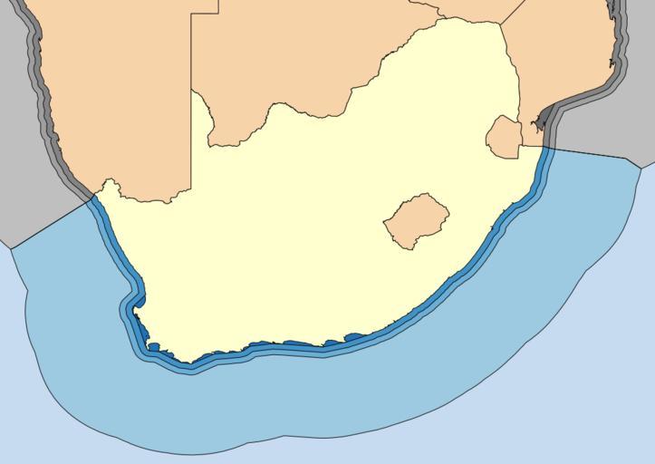
| Keywords: Maritime zones of the South African mainland.svg 2171b5 Internal waters 4292c6 Territorial waters 6baed6 Contiguous zone 9ecae1 Exclusive Economic Zone c6dbef International waters Kaart wat die onderskeie maritime sones van die Suid-Afrikaanse vasteland aandui Let daarop dat hierdie afbakening nie amptelike grense verteenwoordig nie en oor geen regstatus beskik nie Aangedui van donker- na ligblou is die Binnelandse waters Territoriale waters Aanliggende waters Eksklusiewe ekonomiese sones en Internasionale waters Coastline and land borders from Vector Map 0 South African straight baselines from Government Notice No R 543 of 2004 Mozambique straight baselines from Law No 4/96 Outer limits of maritime zones calculated from coastlines and baselines South Africa “Namibia maritime boundary from 1976 photogrammetric determination South Africa “Mozambique maritime boundary from 1993 survey Htonl 2010-03-26 File Maritime zones of South Africa svg Maps of South Africa Exclusive economic zones International borders of South Africa Maps by Htonl Shoreline of South Africa | ||||