MAKE A MEME
View Large Image
| View Original: | Merritt island causeway.jpg (1000x800) | |||
| Download: | Original | Medium | Small | Thumb |
| Courtesy of: | commons.wikimedia.org | More Like This | ||
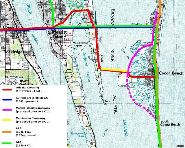
| Keywords: Merritt island causeway.jpg This showns current and former alignments of SR 520 and SR A1A in the Cocoa - Merrit Island - Cocoa Beach area Public domain USGS Background image Current and previous route alignments by Gerald McMillen 2005-11-04 Mcmillen76 wikipedia en en wikipedia Mcmillen76 Original upload log en wikipedia The Bushranger CommonsHelper en wikipedia Merritt_island_causeway jpg 2005-11-04 20 48 Mcmillen76 1000×800× 330252 bytes <nowiki>Public domain USGS Background image Current and previous route alignments by Gerald McMillen This showns current and former alignments of SR 520 and SR A1A in the Cocoa - Merrit Island - Cocoa Beach area </nowiki> __NOTOC__ Bridges in Brevard County Florida Indian River Lagoon Road bridges in the United States | ||||