MAKE A MEME
View Large Image

| View Original: | Meyers_b12_s0482a.jpg (800x659) | |||
| Download: | Original | Medium | Small | Thumb |
| Courtesy of: | commons.wikimedia.org | More Like This | ||
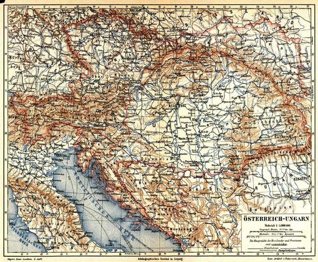
| Keywords: Meyers b12 s0482a.jpg 12 0482 0483 page 482a Seite 482a title Austria-Hungary showing map of Austria-Hungary in German with only part of Germany upper left the Adriatic Sea Italy lower left Russia upper right Romania bottom right c 1888 Titel Österreich-Ungarn als Karte des Österreich-Ungarns mit nur Teil von Deutsches Reich oben links Adriatisches Meer Italien unten links Russland oben rechts Rumanien unten rechts ca 1888 <br><br> in 31 Österreich-Ungarn<br> 7 1 Karte/map - 1 5 000 000 <br> 7 2 Karte in Deutsch map in German <br><br>Auch einfache Karte simple area map 1871-1917 - File Deutsches_Reich1 png Maps from Meyers Konversationslexikon 4th edition Oesterreich-Ungarn Old maps of Austria-Hungary | ||||