MAKE A MEME
View Large Image

| View Original: | Novissima-Rossiae-Tabula-Isaac-Massa-1638.jpg (3237x2737) | |||
| Download: | Original | Medium | Small | Thumb |
| Courtesy of: | commons.wikimedia.org | More Like This | ||
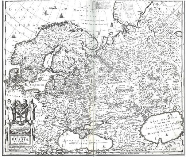
| Keywords: Novissima-Rossiae-Tabula-Isaac-Massa-1638.jpg ąøčāą║ąŠą╝ąŠč čīąĄ; ąĮą░ čüąĄą▓ąĄč ąĄ ąĀąŠčüčüąĖąĖ Novissima Russi├” Tabula ąÉčéą╗ą░čü ąŻą║č ą░ąĖąĮą░ ąĮą░ čüčéą░č ąĖąĮąĮčŗčģ ą║ą░č čéą░čģ čüą▓ąŠčæ ru User Vizu čüą║ą░ąĮąĖč ąŠą▓ą░ąĮąĖąĄ The atlas Ukraine in Antique Maps ; scanned by User Vizu 1638 ąśčüą░ą░ą║ ą ą░čüčüą░ Isaac Massa 100px PD-Art-100 Original upload log page ru wikipedia D0 9B D1 83 D0 BA D0 BE D0 BC D0 BE D1 80 D1 8C D0 B5+ D0 9D D0 BE D0 B2 D0 B5 D0 B9 D1 88 D0 B0 D1 8F+ D0 A0 D0 BE D1 81 D1 81 D0 B8 D1 8F+1638+ D0 90 D0 BC D1 81 D1 82 D0 B5 D1 80 D0 B4 D0 B0 D0 BC+ D0 B0 D0 B2 D1 82 D0 BE D1 80+ D0 98 D1 81 D0 B0 D0 B0 D0 BA+ D0 9C D0 B0 D1 81 D1 81 D0 B0 jpg '0' Upload date User Bytes Dimensions Comment - nowrap 2009-06-12 15 42 39 nowrap Vizu nowrap 8720132 nowrap 3237ū2737 <small><nowiki> ąśąĘąŠą▒č ą░ąČąĄąĮąĖąĄ ą×ą┐ąĖčüą░ąĮąĖąĄ ąÉąĘąĖčÅ - čüą░ą╝ą░čÅ ą▒ąŠą╗čīčłą░čÅ čćą░čüčéčī čüą▓ąĄčéą░ ąōąŠą╗ą╗ą░ąĮą┤čüą║ą░čÅ ą║ą░č čéą░ 1593 ą│ąŠą┤ą░ ą¤ąŠą║ą░ąĘą░ąĮąŠ ąøčāą║ąŠą╝ąŠč čīąĄ ąĮą░ čüąĄą▓ąĄč ąĄ ąśčüč鹊čćąĮąĖą║ ąÉčé</nowiki></small> Old maps of the Black Sea 1638 in Denmark 1638 in Norway 1638 in Russia 1638 in Sweden Maps of Tartary Old maps of Tsardom of Russia Old maps of Denmark Old maps of Norway Old maps of the Caucasus Old maps of Sweden Old maps of Ukraine Isaac Massa 1638 maps Ships on maps 17th-century maps of Georgia Old maps of Armenia 17th-century maps of Azerbaijan Old maps of the Caspian Sea Lukomorie | ||||