MAKE A MEME
View Large Image

| View Original: | Ordnance_Survey_of_Jerusalem_-_By_Captain_W._Wilson,_R.E._under_the_direction_of_Colonel_Sir_Henry_James.1864-5,_revised_edition_1876.jpg (2000x3050) | |||
| Download: | Original | Medium | Small | Thumb |
| Courtesy of: | commons.wikimedia.org | More Like This | ||
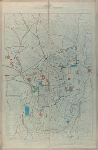
| Keywords: Ordnance Survey of Jerusalem - By Captain W. Wilson, R.E. under the direction of Colonel Sir Henry James.1864-5, revised edition 1876.jpg ū×ūżūö ū®ū ūÖū©ūĢū®ū ūÖū http //web nli org il/sites/NLI/Hebrew/digitallibrary/Laor-Collection/Pages/maps aspx en A large topographic detailed map of Jerusalem Revised edition 1876 of one of the first measurment maps of the city Originally prepared by Charles Wilson as part of the British Ordnance Survey of Jerusalem 1864-5 he ū×ūżūö ūśūĢūżūĢūÆū©ūżūÖū¬ ūÆūōūĢū ūö ū×ūōūĢūÖū¦ū¬ ūĢū×ūżūĢū©ūśū¬ ū®ū ūÖū©ūĢū®ū ūÖū ū×ūöūōūĢū©ūö ū×ū¬ūĢū¦ūĀū¬ 1876 ū®ū ūÉūŚū¬ ū×ū×ūżūĢū¬ ūöū×ūōūÖūōūö ūöū©ūÉū®ūĢūĀūĢū¬ ū®ū ūöūóūÖū© ūöūĢūøūĀūö ūó ūÖ ū”'ū©ū ūĪ ūĢūÖū ūĪūĢū¤ ūæū×ū¦ūĢū© ūæū×ūĪūÆū©ū¬ ūöūĪū¦ū© ūöūæū©ūÖūśūÖ ū®ū ūÖū©ūĢū®ū ūÖū 1864-5 Dimensions 1005x710 mm http //web nli org il/sites/NLI/Hebrew/digitallibrary/pages/viewer aspx presentorid NLI_MAPS_JER DocID NNL_MAPS_JER002368216 Click to enlarge http //web nli org il/sites/NLIS/en/Maps The Eran Laor Cartographic Collection National Library of Israel 2015-12-09 11 22 20 http //web nli org il/sites/NLI/English/Pages/default aspx The National Library of Israel PD-old Old maps of Jerusalem GLAM National Library of Israel Laor collection | ||||