MAKE A MEME
View Large Image

| View Original: | Politically_divided_Gaul,_481.jpg (1242x1144) | |||
| Download: | Original | Medium | Small | Thumb |
| Courtesy of: | commons.wikimedia.org | More Like This | ||
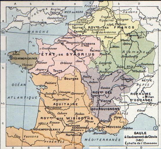
| Keywords: Politically divided Gaul, 481.jpg en The map comes from Vidal-Lablache Atlas général d'histoire et de géographie 1894 fr Gaule à l'avènement de Clovis 481 Paul Vidal de La Blache Atlas général d'histoire et de géographie 1894 en wikipedia 2007-08-19 Srnec wikipedia en File Gaul 481 ru svg PD-old original upload log page en wikipedia Politically_divided_Gaul 2C_481 jpg 2007-08-19 21 36 Srnec 1242×1144×8 343137 bytes <nowiki>The map comes from Vidal-Lablache Atlas général d'histoire et de géographie 1894 PD-old </nowiki> Maps of the Merovingian territory Maps of Gauls France in the 5th century | ||||