MAKE A MEME
View Large Image

| View Original: | Pont_Map_13:_Loch_Eil_and_Loch_Leven.jpg (600x684) | |||
| Download: | Original | Medium | Small | Thumb |
| Courtesy of: | www.flickr.com | More Like This | ||
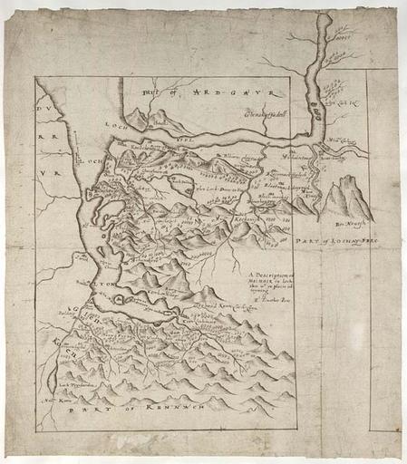
| Keywords: map timothy pont timothypont manuscript scotland glen coe glencoe glen nevis glennevis highlands loch eil locheil loch leven lochleven ben nevis bennevis loch lyon lochlyon nls sketch drawing text writing monochrome texture photo border This map focuses on the area between Glen Coe and Glen Nevis in the western Highlands. It shows part of the Ardgour peninsula to the west west (top) and Rannoch Moor to the southeast (bottom). The north coast of Loch Lyon (Loch Leven) is well depicted. Scotland's highest mountain, the 4406ft (1343m) high Ben Nevis (Bin Neuesh), is clearly drawn in profile (top right). More .... This map focuses on the area between Glen Coe and Glen Nevis in the western Highlands. It shows part of the Ardgour peninsula to the west west (top) and Rannoch Moor to the southeast (bottom). The north coast of Loch Lyon (Loch Leven) is well depicted. Scotland's highest mountain, the 4406ft (1343m) high Ben Nevis (Bin Neuesh), is clearly drawn in profile (top right). More .... | ||||