MAKE A MEME
View Large Image
| View Original: | Punto-concordia-mapa-1941-instituo-geografico-militar-chile.jpg (945x574) | |||
| Download: | Original | Medium | Small | Thumb |
| Courtesy of: | commons.wikimedia.org | More Like This | ||
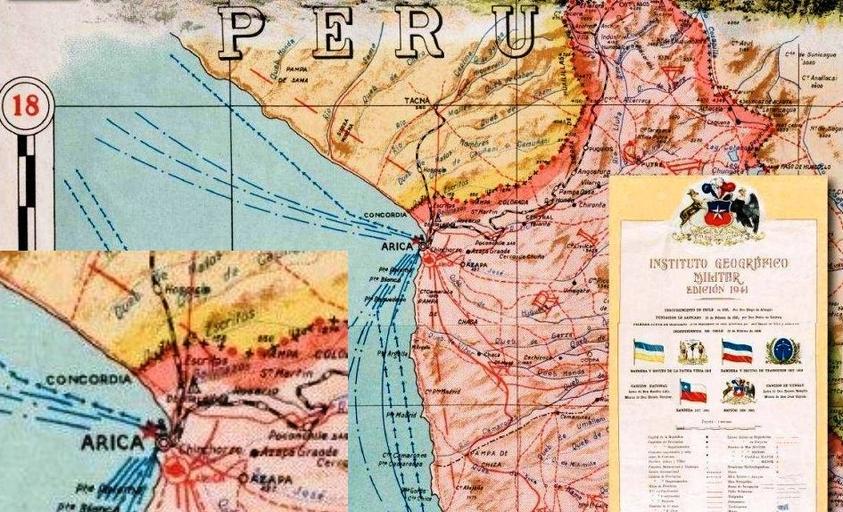
| Keywords: Punto-concordia-mapa-1941-instituo-geografico-militar-chile.jpg es Mapa de Arica publicado por el Instituto Geográfico Militar de Chile en 1941 con ampliación Documento presentado por el Gobierno del Peru ante la Corte Internacional de Justicia en la Controversia Marítima Perú v Chile http //www rree gob pe/temas/Documents/MemoriaCAS pdf Memoria del Gobierno del Perú Volumen I 20 de Marzo de 2009 - Corte Internacional de Justicia Controversia Marítima Perú v Chile Original Instituto Geográfico Militar de Chile in 1941 - Retouched by Goverment of Peru in 2009 2009 Retouched - 1941 Original PD-Chile Maps of maritime boundary between Peru and Chile | ||||