MAKE A MEME
View Large Image

| View Original: | Scandinavia-12th century.png (1650x1950) | |||
| Download: | Original | Medium | Small | Thumb |
| Courtesy of: | commons.wikimedia.org | More Like This | ||
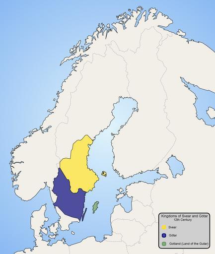
| Keywords: Scandinavia-12th century.png factual accuracy map No definitions no sources The areas have been questioned and are probably accurate at most with some non-obvious definitions See e g //sv wikipedia org/w/index php title Wikipedia Faktafr C3 A5gor oldid 29129369 Hur_r C3 A4ttvisande_ C3 A4r_denna_karta_ 28svear_och_g C3 B6tar 29 3F sw-wp 2014-12-09 Map of Scandinavia in 12th century showing modern borders in grey Made by Ningyou Åboland connecting Åland to mainland Finland is missing from the base map and is thus colourd blue as the sea map Maps of the history of Scandinavia 1150 Geats | ||||