MAKE A MEME
View Large Image

| View Original: | Shameen_Canton.jpg (11984x5952) | |||
| Download: | Original | Medium | Small | Thumb |
| Courtesy of: | commons.wikimedia.org | More Like This | ||
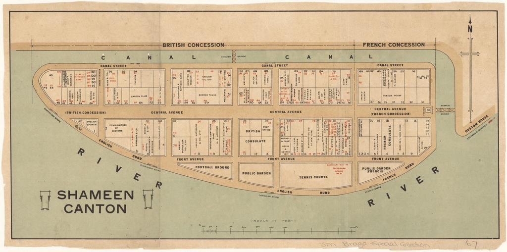
| Keywords: Shameen Canton.jpg LargeImage en Cadastral map of Shameen i e Shamian Island in Canton i e Guangzhou It is one mile in circumference and lies just off Canton which has always been a center of commerce competing with Hong Kong only sixty miles away Because the island was a British and French Concession it was carefully patrolled and connected to the mainland on the northern side by the carefully-guarded English Bridge and a French Bridge on the eastern side The larger western part was English and the eastern part French Each had its own municipal offices even its own police forces Sikhs for the British Annamites for the French The map shows in detail the use of the offices and buildings on the island zh-hant ĺ»Łĺ·žĺ¸‚ć˛™é ˘ĺł¶çš„ĺ °ĺ –ďĽŚä˝żç”¨ç˛µéźłă ŚShameenă Ťć¨™č¨»ă ‚č—Źć–Ľćľłć´˛ĺ ‹ĺ®¶ĺ –ć›¸é¤¨ă ‚ 1920 1929 http //nla gov au/nla map-brsc67 author Custom license marker 2013 02 26 PD-old Uploaded with UploadWizard Shamian Island Old maps of Guangzhou Maps in the National Library of Australia Canton City Guangzhou in the 1920s | ||||