MAKE A MEME
View Large Image

| View Original: | Swine flu infections and deaths by county June 2009.svg (555x351) | |||
| Download: | Original | Medium | Small | Thumb |
| Courtesy of: | commons.wikimedia.org | More Like This | ||
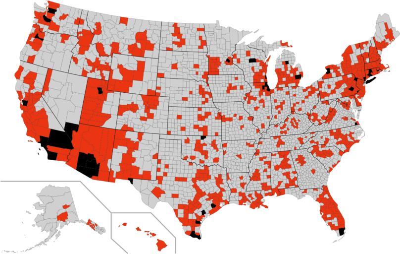
| Keywords: Swine flu infections and deaths by county June 2009.svg en Swine flu infections and deaths by county in the U S June 2009 Utah Minnesota and Virginia counties are colored by zone - positive if average cases per county > 1 Some state data is up to one month old See text for references Based on blank U S map with counties labeled by FIPS code These can be colored by editing the document as text and adding FIPS codes followed by a fill color for each group USA_counties_FIPS_text_addressable svg 2009-06-23 06 52 UTC USA_counties_FIPS_text_addressable svg Mike Serfas derivative work Mike Serfas <span class signature-talk >talk</span> 2009 swine flu outbreak maps 2009 swine flu outbreak in the United States Disease incidence maps of the United States | ||||